
 Maureville
Samoëns
Gréning
Toulouse
Volx
Goudet
Méhoncourt
Saint-Hymer
Pontcarré
Maureville
Samoëns
Gréning
Toulouse
Volx
Goudet
Méhoncourt
Saint-Hymer
Pontcarré
Jardin d'Acclimatation on the map, Orsay, France
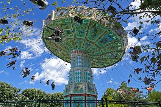
Photo
Where is located Jardin d'Acclimatation
Jardin d'Acclimatation — local attraction, which is located at Bois de Boulogne, Rte de la Prte Dauphine à la Prte des Sablons, 75116 Paris, France and belongs to the category — amusement park. Average visitor rating for this place — 4.3 (according to 11858 ratings, information from open sources and relevant for 2022).
Exact location — Jardin d'Acclimatation, marked on the map with a red marker.
You can get directions to Jardin d'Acclimatation on the map from your location.
What else is interesting in Orsay? You can see all the sights if you go to the city page.
Coordinates
Jardin d'Acclimatation, France coordinates in decimal format: latitude — 48.87770911050244, longitude — 2.2647450796904667. When converted to degrees, minutes, seconds Jardin d'Acclimatation has the following coordinates: 48°52′39.75 north latitude and 2°15′53.08 east longitude.
Nearby cities
The largest cities that are located nearby:
- Boulogne-Billancourt — 16 km
- Orléans — 90 km
- Rouen — 114 km
- Amiens — 133 km
- Reims — 147 km
- Le Mans — 166 km
- Le Havre — 174 km
- Tours — 183 km
- Caen — 193 km
- Lille — 222 km
- Angers — 246 km
- Charleroi
 (Belgium) — 247 km
 - Dijon — 262 km
- Eastbourne
 (United Kingdom) — 265 km
 - Namur (Belgium) — 272 km
- Brussels (Belgium) — 282 km
- Nancy — 292 km
- Metz — 292 km
- Rennes — 293 km
Distance to the capital
Distance to the capital (Paris) is about — 7 km.