
 Maureville
Samoëns
Gréning
Toulouse
Volx
Goudet
Méhoncourt
Saint-Hymer
Pontcarré
Maureville
Samoëns
Gréning
Toulouse
Volx
Goudet
Méhoncourt
Saint-Hymer
Pontcarré
Saint-Étienne-du-Mont on the map, Orsay, France
Photo
Where is located Saint-Étienne-du-Mont
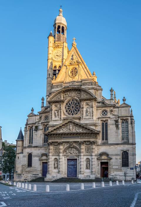
Saint-Étienne-du-Mont — local attraction, which is located at Place Sainte-Geneviève, 75005 Paris, France and belongs to the category — church. Average visitor rating for this place — 4.7 (according to 1834 ratings, information from open sources and relevant for 2022).
Exact location — Saint-Étienne-du-Mont, marked on the map with a red marker.
You can get directions to Saint-Étienne-du-Mont on the map from your location.
What else is interesting in Orsay? You can see all the sights if you go to the city page.
Coordinates
Saint-Étienne-du-Mont, France coordinates in decimal format: latitude — 48.846507407423374, longitude — 2.3480253252233694. When converted to degrees, minutes, seconds Saint-Étienne-du-Mont has the following coordinates: 48°50′47.43 north latitude and 2°20′52.89 east longitude.
Nearby cities
The largest cities that are located nearby:
- Boulogne-Billancourt — 16 km
- Orléans — 90 km
- Rouen — 114 km
- Amiens — 133 km
- Reims — 147 km
- Le Mans — 166 km
- Le Havre — 174 km
- Tours — 183 km
- Caen — 193 km
- Lille — 222 km
- Angers — 246 km
- Charleroi
 (Belgium) — 247 km
 - Dijon — 262 km
- Eastbourne
 (United Kingdom) — 265 km
 - Namur (Belgium) — 272 km
- Brussels (Belgium) — 282 km
- Nancy — 292 km
- Metz — 292 km
- Rennes — 293 km
Distance to the capital
Distance to the capital (Paris) is about — 1 km.