
 Maureville
Samoëns
Gréning
Toulouse
Volx
Goudet
Méhoncourt
Saint-Hymer
Pontcarré
Maureville
Samoëns
Gréning
Toulouse
Volx
Goudet
Méhoncourt
Saint-Hymer
Pontcarré
Hautes-Bruyères State Park on the map, Le Kremlin-Bicêtre, France
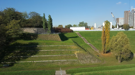
Photo
Where is located Hautes-Bruyères State Park
Hautes-Bruyères State Park — local attraction, which is located at Parc des Hautes-Bruyères, Paris, Av. de la République, 94800 Villejuif, France and belongs to the category — park. Average visitor rating for this place — 4.2 (according to 1091 rating, information from open sources and relevant for 2022).
Exact location — Hautes-Bruyères State Park, marked on the map with a red marker.
You can get directions to Hautes-Bruyères State Park on the map from your location.
What else is interesting in Le Kremlin-Bicêtre? You can see all the sights if you go to the city page.
Coordinates
Hautes-Bruyères State Park, France coordinates in decimal format: latitude — 48.7927495393307, longitude — 2.3519599980385926. When converted to degrees, minutes, seconds Hautes-Bruyères State Park has the following coordinates: 48°47′33.9 north latitude and 2°21′7.06 east longitude.
Nearby cities
The largest cities that are located nearby:
- Boulogne-Billancourt — 9 km
- Orléans — 106 km
- Rouen — 114 km
- Amiens — 120 km
- Reims — 131 km
- Le Havre — 178 km
- Le Mans — 183 km
- Tours — 200 km
- Caen — 201 km
- Lille — 207 km
- Charleroi
 (Belgium) — 230 km
 - Namur (Belgium) — 255 km
- Dijon — 260 km
- Eastbourne
 (United Kingdom) — 260 km
 - Angers — 263 km
- Brussels (Belgium) — 265 km
- Metz — 278 km
- Nancy — 280 km
- Antwerp (Belgium) — 302 km
Distance to the capital
Distance to the capital (Paris) is about — 7 km.