
 Maureville
Samoëns
Gréning
Toulouse
Volx
Goudet
Méhoncourt
Saint-Hymer
Pontcarré
Maureville
Samoëns
Gréning
Toulouse
Volx
Goudet
Méhoncourt
Saint-Hymer
Pontcarré
Gogottes Garden on the map, Guyancourt, France
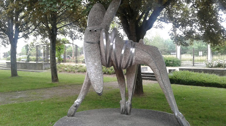
Photo
Where is located Gogottes Garden
Gogottes Garden — local attraction, which is located at 14 Rue Frank Lloyd Wright, 78280 Guyancourt, France and belongs to the category — park. Average visitor rating for this place — 4.1 (according to 121 rating, information from open sources and relevant for 2022).
Exact location — Gogottes Garden, marked on the map with a red marker.
You can get directions to Gogottes Garden on the map from your location.
What else is interesting in Guyancourt? You can see all the sights if you go to the city page.
Coordinates
Gogottes Garden, France coordinates in decimal format: latitude — 48.76586762039674, longitude — 2.0768485980376044. When converted to degrees, minutes, seconds Gogottes Garden has the following coordinates: 48°45′57.12 north latitude and 2°4′36.65 east longitude.
Nearby cities
The largest cities that are located nearby:
- Boulogne-Billancourt — 15 km
- Orléans — 96 km
- Rouen — 103 km
- Amiens — 126 km
- Reims — 151 km
- Le Mans — 162 km
- Le Havre — 163 km
- Caen — 183 km
- Tours — 184 km
- Lille — 218 km
- Angers — 243 km
- Charleroi
 (Belgium) — 247 km
 - Eastbourne
 (United Kingdom) — 254 km
 - Namur (Belgium) — 272 km
- Dijon — 273 km
- Brussels (Belgium) — 280 km
- Rennes — 286 km
- Metz — 299 km
- Nancy — 300 km
Distance to the capital
Distance to the capital (Paris) is about — 23 km.