
 Maureville
Samoëns
Gréning
Toulouse
Volx
Goudet
Méhoncourt
Saint-Hymer
Pontcarré
Maureville
Samoëns
Gréning
Toulouse
Volx
Goudet
Méhoncourt
Saint-Hymer
Pontcarré
Regional Forest of Ferrières on the map, Noisy-le-Grand, France
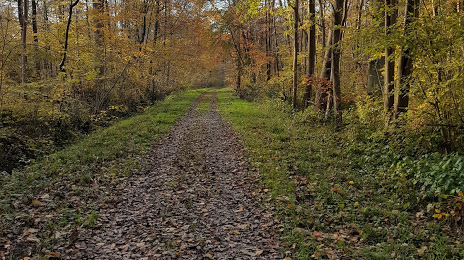
Photo
Where is located Regional Forest of Ferrières
Regional Forest of Ferrières — local attraction, which is located at 77135 Pontcarré, France and belongs to the category — national forest. Average visitor rating for this place — 4.3 (according to 137 ratings, information from open sources and relevant for 2022).
Exact location — Regional Forest of Ferrières, marked on the map with a red marker.
You can get directions to Regional Forest of Ferrières on the map from your location.
What else is interesting in Noisy-le-Grand? You can see all the sights if you go to the city page.
Coordinates
Regional Forest of Ferrières, France coordinates in decimal format: latitude — 48.79469384070042, longitude — 2.7014068980386488. When converted to degrees, minutes, seconds Regional Forest of Ferrières has the following coordinates: 48°47′40.9 north latitude and 2°42′5.06 east longitude.
Nearby cities
The largest cities that are located nearby:
- Boulogne-Billancourt — 23 km
- Orléans — 115 km
- Reims — 116 km
- Amiens — 117 km
- Rouen — 123 km
- Le Havre — 190 km
- Le Mans — 197 km
- Lille — 200 km
- Tours — 213 km
- Caen — 214 km
- Charleroi
 (Belgium) — 218 km
 - Namur (Belgium) — 242 km
- Dijon — 252 km
- Brussels (Belgium) — 254 km
- Metz — 264 km
- Eastbourne
 (United Kingdom) — 265 km
 - Nancy — 266 km
- Angers — 278 km
- Liège (Belgium) — 290 km
Distance to the capital
Distance to the capital (Paris) is about — 26 km.