
 Maureville
Samoëns
Gréning
Toulouse
Volx
Goudet
Méhoncourt
Saint-Hymer
Pontcarré
Maureville
Samoëns
Gréning
Toulouse
Volx
Goudet
Méhoncourt
Saint-Hymer
Pontcarré
Réserve Naturelle Nationale de Camargue on the map, Arles, France
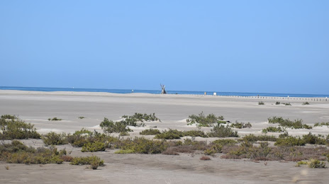
Photo
Where is located Réserve Naturelle Nationale de Camargue
Réserve Naturelle Nationale de Camargue — local attraction, which is located at Mas de la Capelière - c134, Rte de Fielouse, 13200 Arles, France and belongs to the category — national reserve. Average visitor rating for this place — 4.4 (according to 26 ratings, information from open sources and relevant for 2022).
Exact location — Réserve Naturelle Nationale de Camargue, marked on the map with a red marker.
You can get directions to Réserve Naturelle Nationale de Camargue on the map from your location.
What else is interesting in Arles? You can see all the sights if you go to the city page.
Coordinates
Réserve Naturelle Nationale de Camargue, France coordinates in decimal format: latitude — 43.53414818904014, longitude — 4.6426991978603676. When converted to degrees, minutes, seconds Réserve Naturelle Nationale de Camargue has the following coordinates: 43°32′2.93 north latitude and 4°38′33.72 east longitude.
Nearby cities
The largest cities that are located nearby:
- Nimes — 28 km
- Montpellier — 61 km
- Aix-en-Provence — 68 km
- Marseille — 73 km
- Toulon — 121 km
- Perpignan — 178 km
- Grenoble — 188 km
- Saint-Étienne — 196 km
- Nice — 211 km
- Lyon — 231 km
- Villeurbanne — 233 km
- Toulouse — 255 km
- Clermont-Ferrand — 261 km
- Turin
 (Italy) — 284 km
 - Mataró
 (Spain) — 298 km
 - Geneva
 (Switzerland) — 302 km
 - Sabadell (Spain) — 315 km
- Badalona (Spain) — 316 km
- Santa Coloma de Gramenet (Spain) — 318 km
Distance to the capital
Distance to the capital (Paris) is about — 618 km.