
 Maureville
Samoëns
Gréning
Toulouse
Volx
Goudet
Méhoncourt
Saint-Hymer
Pontcarré
Maureville
Samoëns
Gréning
Toulouse
Volx
Goudet
Méhoncourt
Saint-Hymer
Pontcarré
Château d'Onet-le-Château on the map, Rodez, France
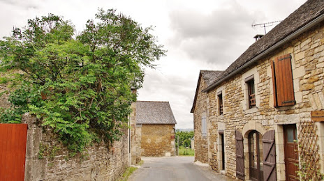
Photo
Where is located Château d'Onet-le-Château
Château d'Onet-le-Château — local attraction, which is located at 12850 Onet-le-Château, France and belongs to the category — castle. Average visitor rating for this place — 4.3 (according to 141 rating, information from open sources and relevant for 2022).
Exact location — Château d'Onet-le-Château, marked on the map with a red marker.
You can get directions to Château d'Onet-le-Château on the map from your location.
What else is interesting in Rodez? You can see all the sights if you go to the city page.
Coordinates
Château d'Onet-le-Château, France coordinates in decimal format: latitude — 44.37984110582904, longitude — 2.5614255775318218. When converted to degrees, minutes, seconds Château d'Onet-le-Château has the following coordinates: 44°22′47.43 north latitude and 2°33′41.13 east longitude.
Nearby cities
The largest cities that are located nearby:
- Toulouse — 122 km
- Montpellier — 132 km
- Nimes — 153 km
- Clermont-Ferrand — 163 km
- Saint-Étienne — 185 km
- Perpignan — 185 km
- Limoges — 193 km
- Lyon — 234 km
- Villeurbanne — 238 km
- Aix-en-Provence — 247 km
- Marseille — 253 km
- Bordeaux — 253 km
- Grenoble — 262 km
- Toulon — 303 km
- Mataró
 (Spain) — 311 km
 - Terrassa (Spain) — 312 km
- Sabadell (Spain) — 312 km
- Badalona (Spain) — 322 km
- Santa Coloma de Gramenet (Spain) — 323 km
Distance to the capital
Distance to the capital (Paris) is about — 498 km.