
 Maureville
Samoëns
Gréning
Toulouse
Volx
Goudet
Méhoncourt
Saint-Hymer
Pontcarré
Maureville
Samoëns
Gréning
Toulouse
Volx
Goudet
Méhoncourt
Saint-Hymer
Pontcarré
National Gendarmerie Museum on the map, Dammarie-lès-Lys, France
Photo
Where is located National Gendarmerie Museum
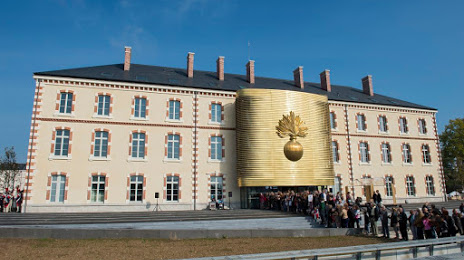
National Gendarmerie Museum — local attraction, which is located at 1-3 Rue Emile Leclerc, 77000 Melun, France and belongs to the category — museum. Average visitor rating for this place — 4.6 (according to 505 ratings, information from open sources and relevant for 2022).
Exact location — National Gendarmerie Museum, marked on the map with a red marker.
You can get directions to National Gendarmerie Museum on the map from your location.
What else is interesting in Dammarie-lès-Lys? You can see all the sights if you go to the city page.
Coordinates
National Gendarmerie Museum, France coordinates in decimal format: latitude — 48.545458665449736, longitude — 2.65295419802984. When converted to degrees, minutes, seconds National Gendarmerie Museum has the following coordinates: 48°32′43.65 north latitude and 2°39′10.64 east longitude.
Nearby cities
The largest cities that are located nearby:
- Boulogne-Billancourt — 46 km
- Orléans — 86 km
- Reims — 130 km
- Rouen — 151 km
- Amiens — 154 km
- Le Mans — 189 km
- Tours — 191 km
- Le Havre — 211 km
- Dijon — 223 km
- Caen — 229 km
- Lille — 236 km
- Charleroi
 (Belgium) — 245 km
 - Nancy — 260 km
- Metz — 265 km
- Angers — 265 km
- Namur (Belgium) — 267 km
- Brussels (Belgium) — 285 km
- Besançon — 291 km
- Eastbourne
 (United Kingdom) — 298 km
Distance to the capital
Distance to the capital (Paris) is about — 41 km.