
 Maureville
Samoëns
Gréning
Toulouse
Volx
Goudet
Méhoncourt
Saint-Hymer
Pontcarré
Maureville
Samoëns
Gréning
Toulouse
Volx
Goudet
Méhoncourt
Saint-Hymer
Pontcarré
Parmelan on the map, Annecy, France
Photo
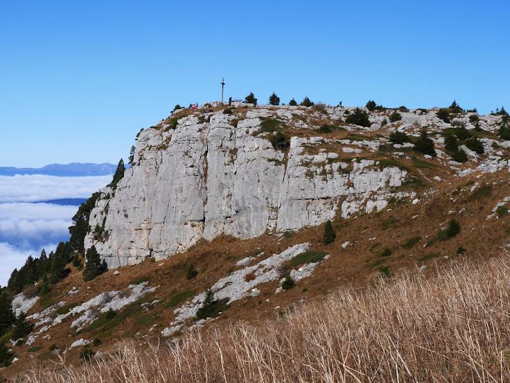
Where is located Parmelan
Parmelan — local attraction, which is located at 290 m and belongs to the category — -. Average visitor rating for this place — 4.7 (according to 38 ratings, information from open sources and relevant for 2022).
Exact location — Parmelan, marked on the map with a red marker.
You can get directions to Parmelan on the map from your location.
What else is interesting in Annecy? You can see all the sights if you go to the city page.
Coordinates
Parmelan, France coordinates in decimal format: latitude — 45.90592325143314, longitude — 6.1333195979388035. When converted to degrees, minutes, seconds Parmelan has the following coordinates: 45°54′21.32 north latitude and 6°7′59.95 east longitude.
Nearby cities
The largest cities that are located nearby:
- Geneva
 (Switzerland) — 33 km
 - Lausanne (Switzerland) — 79 km
- Grenoble — 85 km
- Villeurbanne — 97 km
- Lyon — 101 km
- Saint-Étienne — 144 km
- Besançon — 148 km
- Turin
 (Italy) — 152 km
 - Bern (Switzerland) — 153 km
- Dijon — 177 km
- Novara (Italy) — 200 km
- Basel (Switzerland) — 215 km
- Mulhouse — 224 km
- Clermont-Ferrand — 235 km
- Milan (Italy) — 242 km
- Zurich (Switzerland) — 243 km
- Monza (Italy) — 246 km
- Nice — 258 km
- Freiburg
 (Germany) — 264 km
Distance to the capital
Distance to the capital (Paris) is about — 434 km.