Hayward — Salina
Hayward — Pine Bluff
Hayward — Elizabethtown
Hayward — Lodi
Hayward — Deersville
Hayward — W H 'Bud' Barron Airport
Hayward — Burl Road
Hayward — Felton
Hayward — Lyles
Hayward — Bandon
Hayward — Maine
Hayward — Manchester
Hayward — Centerport
Hayward — Twin Lakes
Hayward — Suisun City
Hayward — Dayr Samet
Hayward — Allenport
Hayward — Greenleaf
Hayward — Harvey
Hayward — West Bend distance, route on the map
Distance by car
Distance between Hayward, California, United States and West Bend, Wisconsin, United States by car is — km, or miles. To travel this distance by car, you need minute, or h.
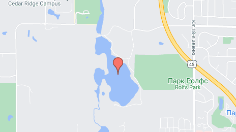
Route on the map, driving directions
Car route Hayward — West Bend was created automatically. The road on the map is shown as a blue line. By moving the markers, you can create a new route through the points you need.
Distance by plane
If you decide to take a trip Hayward West Bend by plane, then you have to fly the distance — 2914 km or 1807 miles. It is marked on the map with a gray line (between two points in a straight line).
Flight time
Estimated flight time Hayward West Bend by plane at cruising speed 750 km / h will be — 3 h. and 53 min.
Direction of movement
United States, Hayward — right-hand traffic. United States, West Bend — right-hand traffic.
Difference in time
Hayward and West Bend are in different time zones. The time difference is 2 hours (UTC -7 America/Los_Angeles, UTC -5 America/Chicago).
Interesting Facts
Information on alternative ways to get to your destination.
The length of this distance is about 7.3% of the total length of the equator.
The percentage of the population is clearly shown in the graph:
Hayward — 140,494, West Bend — 29,431 residents (less by 111,063).
The cost of travel
Calculate the cost of the trip yourself using the fuel consumption calculator, changing the data in the table.
Calculate the cost of other distances from the starting point — Hayward.