
 Maureville
Samoëns
Gréning
Toulouse
Volx
Goudet
Méhoncourt
Saint-Hymer
Pontcarré
Maureville
Samoëns
Gréning
Toulouse
Volx
Goudet
Méhoncourt
Saint-Hymer
Pontcarré
Roseraie de L'Haÿ on the map, Cachan, France
Photo
Where is located Roseraie de L'Haÿ
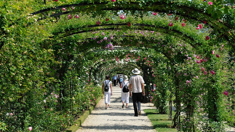
Roseraie de L'Haÿ — local attraction, which is located at Rue Albert, Rue Watel, 94240 L'Haÿ-les-Roses, France and belongs to the category — park. Average visitor rating for this place — 4.4 (according to 1367 ratings, information from open sources and relevant for 2022).
Exact location — Roseraie de L'Haÿ, marked on the map with a red marker.
You can get directions to Roseraie de L'Haÿ on the map from your location.
What else is interesting in Cachan? You can see all the sights if you go to the city page.
Coordinates
Roseraie de L'Haÿ, France coordinates in decimal format: latitude — 48.77626922772214, longitude — 2.3346032980379823. When converted to degrees, minutes, seconds Roseraie de L'Haÿ has the following coordinates: 48°46′34.57 north latitude and 2°20′4.57 east longitude.
Nearby cities
The largest cities that are located nearby:
- Boulogne-Billancourt — 9 km
- Orléans — 103 km
- Rouen — 114 km
- Amiens — 122 km
- Reims — 133 km
- Le Havre — 178 km
- Le Mans — 180 km
- Tours — 198 km
- Caen — 200 km
- Lille — 209 km
- Charleroi
 (Belgium) — 233 km
 - Namur (Belgium) — 257 km
- Dijon — 260 km
- Angers — 261 km
- Eastbourne
 (United Kingdom) — 261 km
 - Brussels (Belgium) — 268 km
- Metz — 281 km
- Nancy — 281 km
- Antwerp (Belgium) — 304 km
Distance to the capital
Distance to the capital (Paris) is about — 9 km.