
 Maureville
Samoëns
Gréning
Toulouse
Volx
Goudet
Méhoncourt
Saint-Hymer
Pontcarré
Maureville
Samoëns
Gréning
Toulouse
Volx
Goudet
Méhoncourt
Saint-Hymer
Pontcarré
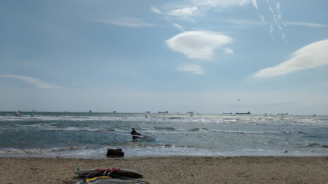
Plage du Cavaou on the map, Fos-sur-Mer, France
Photo
Where is located Plage du Cavaou
Plage du Cavaou — local attraction, which is located at no data and belongs to the category — -. Average visitor rating for this place — 4.2 (according to 85 ratings, information from open sources and relevant for 2022).
Exact location — Plage du Cavaou, marked on the map with a red marker.
You can get directions to Plage du Cavaou on the map from your location.
What else is interesting in Fos-sur-Mer? You can see all the sights if you go to the city page.
Coordinates
Plage du Cavaou, France coordinates in decimal format: latitude — 43.43111441323265, longitude — 4.918383873571095. When converted to degrees, minutes, seconds Plage du Cavaou has the following coordinates: 43°25′52.01 north latitude and 4°55′6.18 east longitude.
Nearby cities
The largest cities that are located nearby:
- Marseille — 38 km
- Aix-en-Provence — 41 km
- Nimes — 64 km
- Toulon — 87 km
- Montpellier — 88 km
- Perpignan — 186 km
- Nice — 188 km
- Grenoble — 203 km
- Saint-Étienne — 226 km
- Lyon — 257 km
- Villeurbanne — 258 km
- Turin
 (Italy) — 280 km
 - Toulouse — 281 km
- Mataró
 (Spain) — 295 km
 - Clermont-Ferrand — 296 km
- Badalona (Spain) — 314 km
- Sabadell (Spain) — 314 km
- Santa Coloma de Gramenet (Spain) — 316 km
- Geneva
 (Switzerland) — 319 km
Distance to the capital
Distance to the capital (Paris) is about — 635 km.