
 Maureville
Samoëns
Gréning
Toulouse
Volx
Goudet
Méhoncourt
Saint-Hymer
Pontcarré
Maureville
Samoëns
Gréning
Toulouse
Volx
Goudet
Méhoncourt
Saint-Hymer
Pontcarré
Plage de Sainte-Marguerite on the map, Saint-Nazaire, France
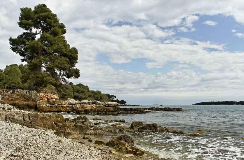
Photo
Where is located Plage de Sainte-Marguerite
Plage de Sainte-Marguerite — local attraction, which is located at no data and belongs to the category — -. Average visitor rating for this place — 4.7 (according to 81 rating, information from open sources and relevant for 2022).
Exact location — Plage de Sainte-Marguerite, marked on the map with a red marker.
You can get directions to Plage de Sainte-Marguerite on the map from your location.
What else is interesting in Saint-Nazaire? You can see all the sights if you go to the city page.
Coordinates
Plage de Sainte-Marguerite, France coordinates in decimal format: latitude — 47.24248456616307, longitude — -2.310555718230302. When converted to degrees, minutes, seconds Plage de Sainte-Marguerite has the following coordinates: 47°14′32.94 north latitude and -2°18′38 east longitude.
Nearby cities
The largest cities that are located nearby:
- Nantes — 50 km
- Rennes — 101 km
- Angers — 125 km
- Le Mans — 196 km
- Brest — 208 km
- Tours — 217 km
- Caen — 250 km
- Le Havre — 297 km
- Bordeaux — 298 km
- Limoges — 311 km
- Orléans — 313 km
- Rouen — 338 km
- Boulogne-Billancourt — 367 km
- Bournemouth
 (United Kingdom) — 382 km
 - Exeter (United Kingdom) — 392 km
- Portsmouth (United Kingdom) — 400 km
- Southampton (United Kingdom) — 406 km
- Eastbourne (United Kingdom) — 424 km
- Amiens — 433 km
Distance to the capital
Distance to the capital (Paris) is about — 390 km.