
 Maureville
Samoëns
Gréning
Toulouse
Volx
Goudet
Méhoncourt
Saint-Hymer
Pontcarré
Maureville
Samoëns
Gréning
Toulouse
Volx
Goudet
Méhoncourt
Saint-Hymer
Pontcarré
Parc Stalingrad on the map, La Courneuve, France
Photo
Where is located Parc Stalingrad
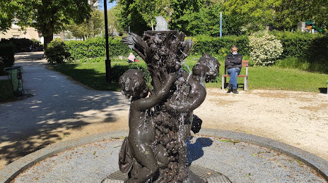
Parc Stalingrad — local attraction, which is located at Rue Bernard et Mazoyer, 93300 Aubervilliers, France and belongs to the category — park. Average visitor rating for this place — 4.0 (according to 312 ratings, information from open sources and relevant for 2022).
Exact location — Parc Stalingrad, marked on the map with a red marker.
You can get directions to Parc Stalingrad on the map from your location.
What else is interesting in La Courneuve? You can see all the sights if you go to the city page.
Coordinates
Parc Stalingrad, France coordinates in decimal format: latitude — 48.911421723008736, longitude — 2.383268998042774. When converted to degrees, minutes, seconds Parc Stalingrad has the following coordinates: 48°54′41.12 north latitude and 2°22′59.77 east longitude.
Nearby cities
The largest cities that are located nearby:
- Boulogne-Billancourt — 15 km
- Amiens — 107 km
- Rouen — 109 km
- Orléans — 119 km
- Reims — 123 km
- Le Havre — 176 km
- Le Mans — 192 km
- Lille — 193 km
- Caen — 202 km
- Tours — 213 km
- Charleroi
 (Belgium) — 218 km
 - Namur (Belgium) — 243 km
- Eastbourne
 (United Kingdom) — 251 km
 - Brussels (Belgium) — 252 km
- Dijon — 266 km
- Angers — 274 km
- Metz — 274 km
- Nancy — 278 km
- Antwerp (Belgium) — 288 km
Distance to the capital
Distance to the capital (Paris) is about — 7 km.