
 Maureville
Samoëns
Gréning
Toulouse
Volx
Goudet
Méhoncourt
Saint-Hymer
Pontcarré
Maureville
Samoëns
Gréning
Toulouse
Volx
Goudet
Méhoncourt
Saint-Hymer
Pontcarré
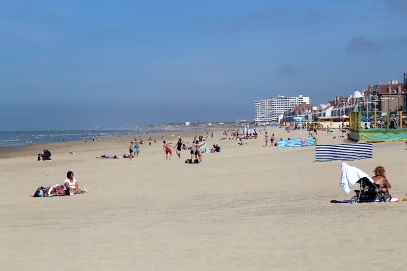
Beach of Malo-les-Bains (Plage de Malo-les-Bains) on the map, Dunkirk, France
Photo
Where is located Beach of Malo-les-Bains (Plage de Malo-les-Bains)
Beach of Malo-les-Bains (Plage de Malo-les-Bains) — local attraction, which is located at no data and belongs to the category — -. Average visitor rating for this place — 4.4 (according to 9056 ratings, information from open sources and relevant for 2022).
Exact location — Beach of Malo-les-Bains (Plage de Malo-les-Bains), marked on the map with a red marker.
You can get directions to Beach of Malo-les-Bains (Plage de Malo-les-Bains) on the map from your location.
What else is interesting in Dunkirk? You can see all the sights if you go to the city page.
Coordinates
Beach of Malo-les-Bains (Plage de Malo-les-Bains), France coordinates in decimal format: latitude — 51.04931415491974, longitude — 2.386658990474053. When converted to degrees, minutes, seconds Beach of Malo-les-Bains (Plage de Malo-les-Bains) has the following coordinates: 51°2′57.53 north latitude and 2°23′11.97 east longitude.
Nearby cities
The largest cities that are located nearby:
- Lille — 65 km
- Amiens — 126 km
- Southend-on-Sea
 (United Kingdom) — 128 km
 - Gillingham (United Kingdom) — 132 km
- Brussels
 (Belgium) — 139 km
 - Ipswich (United Kingdom) — 141 km
- Antwerp (Belgium) — 142 km
- Basildon (United Kingdom) — 143 km
- Eastbourne (United Kingdom) — 149 km
- Chelmsford (United Kingdom) — 152 km
- Charleroi (Belgium) — 161 km
- Rotterdam
 (Netherlands) — 174 km
 - The Hague (Netherlands) — 174 km
- Breda (Netherlands) — 176 km
- Crawley (United Kingdom) — 178 km
- Dordrecht (Netherlands) — 180 km
- London (United Kingdom) — 180 km
- Sutton (United Kingdom) — 181 km
- Zoetermeer (Netherlands) — 183 km
Distance to the capital
Distance to the capital (Paris) is about — 244 km.