
 Maureville
Samoëns
Gréning
Toulouse
Volx
Goudet
Méhoncourt
Saint-Hymer
Pontcarré
Maureville
Samoëns
Gréning
Toulouse
Volx
Goudet
Méhoncourt
Saint-Hymer
Pontcarré
Fort Vallières on the map, Dunkirk, France
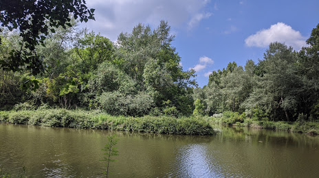
Photo
Where is located Fort Vallières
Fort Vallières — local attraction, which is located at Rte du Golf, 59380 Téteghem-Coudekerque-Village, France and belongs to the category — national forest. Average visitor rating for this place — 4.2 (according to 327 ratings, information from open sources and relevant for 2022).
Exact location — Fort Vallières, marked on the map with a red marker.
You can get directions to Fort Vallières on the map from your location.
What else is interesting in Dunkirk? You can see all the sights if you go to the city page.
Coordinates
Fort Vallières, France coordinates in decimal format: latitude — 50.99717531813565, longitude — 2.4040479981177874. When converted to degrees, minutes, seconds Fort Vallières has the following coordinates: 50°59′49.83 north latitude and 2°24′14.57 east longitude.
Nearby cities
The largest cities that are located nearby:
- Lille — 65 km
- Amiens — 126 km
- Southend-on-Sea
 (United Kingdom) — 128 km
 - Gillingham (United Kingdom) — 132 km
- Brussels
 (Belgium) — 139 km
 - Ipswich (United Kingdom) — 141 km
- Antwerp (Belgium) — 142 km
- Basildon (United Kingdom) — 143 km
- Eastbourne (United Kingdom) — 149 km
- Chelmsford (United Kingdom) — 152 km
- Charleroi (Belgium) — 161 km
- Rotterdam
 (Netherlands) — 174 km
 - The Hague (Netherlands) — 174 km
- Breda (Netherlands) — 176 km
- Crawley (United Kingdom) — 178 km
- Dordrecht (Netherlands) — 180 km
- London (United Kingdom) — 180 km
- Sutton (United Kingdom) — 181 km
- Zoetermeer (Netherlands) — 183 km
Distance to the capital
Distance to the capital (Paris) is about — 238 km.