
 Maureville
Samoëns
Gréning
Toulouse
Volx
Goudet
Méhoncourt
Saint-Hymer
Pontcarré
Maureville
Samoëns
Gréning
Toulouse
Volx
Goudet
Méhoncourt
Saint-Hymer
Pontcarré
Hollow Park of Hell (Parc du Creux de l'Enfer) on the map, Aubière, France
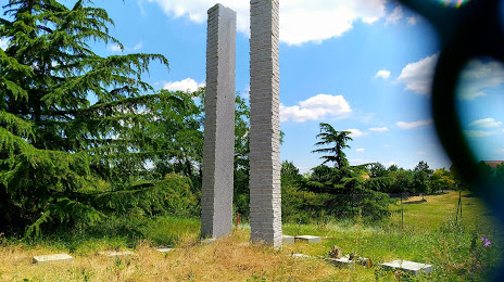
Photo
Where is located Hollow Park of Hell (Parc du Creux de l'Enfer)
Hollow Park of Hell (Parc du Creux de l'Enfer) — local attraction, which is located at 11 Le Cottage des Landais, 63000 Clermont-Ferrand, France and belongs to the category — park. Average visitor rating for this place — 3.9 (according to 312 ratings, information from open sources and relevant for 2022).
Exact location — Hollow Park of Hell (Parc du Creux de l'Enfer), marked on the map with a red marker.
You can get directions to Hollow Park of Hell (Parc du Creux de l'Enfer) on the map from your location.
What else is interesting in Aubière? You can see all the sights if you go to the city page.
Coordinates
Hollow Park of Hell (Parc du Creux de l'Enfer), France coordinates in decimal format: latitude — 45.76570555725605, longitude — 3.1156506979340737. When converted to degrees, minutes, seconds Hollow Park of Hell (Parc du Creux de l'Enfer) has the following coordinates: 45°45′56.54 north latitude and 3°6′56.34 east longitude.
Nearby cities
The largest cities that are located nearby:
- Clermont-Ferrand — 3 km
- Saint-Étienne — 105 km
- Lyon — 133 km
- Villeurbanne — 137 km
- Limoges — 143 km
- Grenoble — 213 km
- Dijon — 226 km
- Nimes — 234 km
- Geneva
 (Switzerland) — 237 km
 - Montpellier — 244 km
- Orléans — 254 km
- Tours — 257 km
- Toulouse — 272 km
- Besançon — 274 km
- Lausanne (Switzerland) — 281 km
- Bordeaux — 306 km
- Aix-en-Provence — 309 km
- Marseille — 327 km
- Le Mans — 329 km
Distance to the capital
Distance to the capital (Paris) is about — 349 km.