
 Maureville
Samoëns
Gréning
Toulouse
Volx
Goudet
Méhoncourt
Saint-Hymer
Pontcarré
Maureville
Samoëns
Gréning
Toulouse
Volx
Goudet
Méhoncourt
Saint-Hymer
Pontcarré
L'épicerie Tour Marguerite on the map, Argentan, France
Photo
Where is located L'épicerie Tour Marguerite
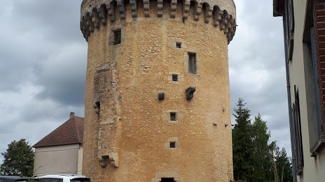
L'épicerie Tour Marguerite — local attraction, which is located at 57 Rue de la République, 61200 Argentan, France and belongs to the category — grocery store. Average visitor rating for this place — 4.4 (according to 21 rating, information from open sources and relevant for 2022).
Exact location — L'épicerie Tour Marguerite, marked on the map with a red marker.
You can get directions to L'épicerie Tour Marguerite on the map from your location.
What else is interesting in Argentan? You can see all the sights if you go to the city page.
Coordinates
L'épicerie Tour Marguerite, France coordinates in decimal format: latitude — 48.74600690641328, longitude — -0.020981501963078082. When converted to degrees, minutes, seconds L'épicerie Tour Marguerite has the following coordinates: 48°44′45.62 north latitude and -0°1′15.53 east longitude.
Nearby cities
The largest cities that are located nearby:
- Caen — 55 km
- Le Mans — 83 km
- Le Havre — 83 km
- Rouen — 111 km
- Rennes — 141 km
- Angers — 146 km
- Tours — 158 km
- Boulogne-Billancourt — 165 km
- Orléans — 170 km
- Nantes — 204 km
- Amiens — 208 km
- Eastbourne
 (United Kingdom) — 225 km
 - Portsmouth (United Kingdom) — 241 km
- Bournemouth (United Kingdom) — 254 km
- Southampton (United Kingdom) — 258 km
- Crawley (United Kingdom) — 262 km
- Sutton (United Kingdom) — 290 km
- Gillingham (United Kingdom) — 295 km
- Reims — 298 km
Distance to the capital
Distance to the capital (Paris) is about — 174 km.