
 Maureville
Samoëns
Gréning
Toulouse
Volx
Goudet
Méhoncourt
Saint-Hymer
Pontcarré
Maureville
Samoëns
Gréning
Toulouse
Volx
Goudet
Méhoncourt
Saint-Hymer
Pontcarré
Saint Andrew's Church of Niort on the map, Niort, France
Photo
Where is located Saint Andrew's Church of Niort
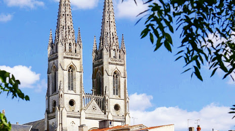
Saint Andrew's Church of Niort — local attraction, which is located at 57 Rue Saint-André, 79000 Niort, France and belongs to the category — catholic church. Average visitor rating for this place — 4.1 (according to 80 ratings, information from open sources and relevant for 2022).
Exact location — Saint Andrew's Church of Niort, marked on the map with a red marker.
You can get directions to Saint Andrew's Church of Niort on the map from your location.
What else is interesting in Niort? You can see all the sights if you go to the city page.
Coordinates
Saint Andrew's Church of Niort, France coordinates in decimal format: latitude — 46.32774123609536, longitude — -0.46231360204688654. When converted to degrees, minutes, seconds Saint Andrew's Church of Niort has the following coordinates: 46°19′39.87 north latitude and -0°27′44.33 east longitude.
Nearby cities
The largest cities that are located nearby:
- Angers — 128 km
- Nantes — 128 km
- Limoges — 144 km
- Tours — 146 km
- Bordeaux — 165 km
- Le Mans — 192 km
- Rennes — 218 km
- Orléans — 248 km
- Clermont-Ferrand — 280 km
- Caen — 316 km
- Toulouse — 337 km
- Boulogne-Billancourt — 341 km
- Le Havre — 353 km
- San Sebastián
 (Spain) — 354 km
 - Rouen — 363 km
- Brest — 373 km
- Saint-Étienne — 389 km
- Bilbao (Spain) — 393 km
- Pamplona (Spain) — 400 km
Distance to the capital
Distance to the capital (Paris) is about — 352 km.