
 Maureville
Samoëns
Gréning
Toulouse
Volx
Goudet
Méhoncourt
Saint-Hymer
Pontcarré
Maureville
Samoëns
Gréning
Toulouse
Volx
Goudet
Méhoncourt
Saint-Hymer
Pontcarré
La Forêt Escargot on the map, Montrouge, France
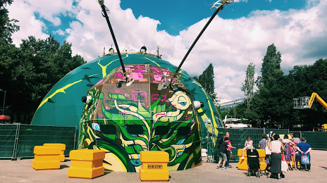
Photo
Where is located La Forêt Escargot
La Forêt Escargot — local attraction, which is located at 1 Pl. du 11 Novembre, 92240 Malakoff, France and belongs to the category — museum. Average visitor rating for this place — 4.9 (according to 21 rating, information from open sources and relevant for 2022).
Exact location — La Forêt Escargot, marked on the map with a red marker.
You can get directions to La Forêt Escargot on the map from your location.
What else is interesting in Montrouge? You can see all the sights if you go to the city page.
Coordinates
La Forêt Escargot, France coordinates in decimal format: latitude — 48.820798959095214, longitude — 2.301646298039549. When converted to degrees, minutes, seconds La Forêt Escargot has the following coordinates: 48°49′14.88 north latitude and 2°18′5.93 east longitude.
Nearby cities
The largest cities that are located nearby:
- Boulogne-Billancourt — 6 km
- Orléans — 105 km
- Rouen — 112 km
- Amiens — 119 km
- Reims — 133 km
- Le Havre — 175 km
- Le Mans — 180 km
- Caen — 198 km
- Tours — 199 km
- Lille — 207 km
- Charleroi
 (Belgium) — 231 km
 - Namur (Belgium) — 256 km
- Eastbourne
 (United Kingdom) — 258 km
 - Angers — 261 km
- Dijon — 263 km
- Brussels (Belgium) — 266 km
- Metz — 281 km
- Nancy — 283 km
- Antwerp (Belgium) — 302 km
Distance to the capital
Distance to the capital (Paris) is about — 5 km.