
 Maureville
Samoëns
Gréning
Toulouse
Volx
Goudet
Méhoncourt
Saint-Hymer
Pontcarré
Maureville
Samoëns
Gréning
Toulouse
Volx
Goudet
Méhoncourt
Saint-Hymer
Pontcarré
Île Sainte-Marguerite on the map, Cannes, France
Photo
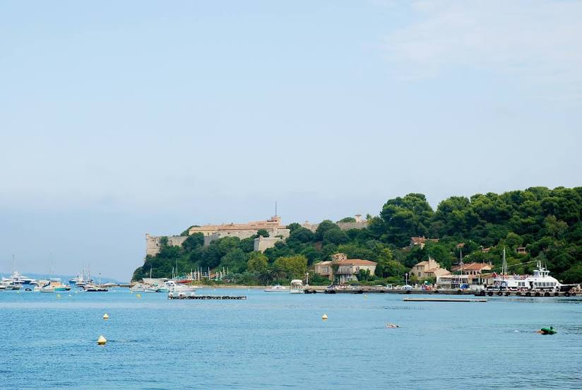
Where is located Île Sainte-Marguerite
Île Sainte-Marguerite — local attraction, which is located at 3 km and belongs to the category — -. Average visitor rating for this place — 4.7 (according to 586 ratings, information from open sources and relevant for 2022).
Exact location — Île Sainte-Marguerite, marked on the map with a red marker.
You can get directions to Île Sainte-Marguerite on the map from your location.
What else is interesting in Cannes? You can see all the sights if you go to the city page.
Coordinates
Île Sainte-Marguerite, France coordinates in decimal format: latitude — 43.51944431822402, longitude — 7.051099473754982. When converted to degrees, minutes, seconds Île Sainte-Marguerite has the following coordinates: 43°31′10 north latitude and 7°3′3.96 east longitude.
Nearby cities
The largest cities that are located nearby:
- Nice — 26 km
- Toulon — 100 km
- Aix-en-Provence — 126 km
- Marseille — 136 km
- Turin
 (Italy) — 176 km
 - Genoa (Italy) — 179 km
- Grenoble — 207 km
- Nimes — 214 km
- Novara (Italy) — 244 km
- Montpellier — 252 km
- Livorno (Italy) — 264 km
- Milan (Italy) — 270 km
- Monza (Italy) — 285 km
- Saint-Étienne — 292 km
- Parma (Italy) — 294 km
- Villeurbanne — 295 km
- Lyon — 297 km
- Geneva
 (Switzerland) — 300 km
 - Bergamo (Italy) — 314 km
Distance to the capital
Distance to the capital (Paris) is about — 695 km.