
 Maureville
Samoëns
Gréning
Toulouse
Volx
Goudet
Méhoncourt
Saint-Hymer
Pontcarré
Maureville
Samoëns
Gréning
Toulouse
Volx
Goudet
Méhoncourt
Saint-Hymer
Pontcarré
Basilique Saint-Sauveur on the map, Dinan, France
Photo
Where is located Basilique Saint-Sauveur
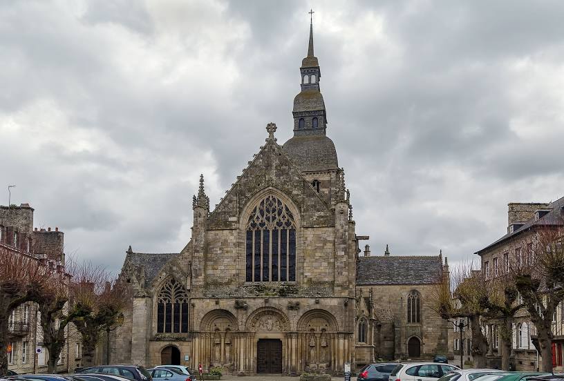
Basilique Saint-Sauveur — local attraction, which is located at 14 Pl. Saint-Sauveur, 22100 Dinan, France and belongs to the category — basilica. Average visitor rating for this place — 4.4 (according to 1144 ratings, information from open sources and relevant for 2022).
Exact location — Basilique Saint-Sauveur, marked on the map with a red marker.
You can get directions to Basilique Saint-Sauveur on the map from your location.
What else is interesting in Dinan? You can see all the sights if you go to the city page.
Coordinates
Basilique Saint-Sauveur, France coordinates in decimal format: latitude — 48.453518900971915, longitude — -2.041788701973398. When converted to degrees, minutes, seconds Basilique Saint-Sauveur has the following coordinates: 48°27′12.67 north latitude and -2°2′30.44 east longitude.
Nearby cities
The largest cities that are located nearby:
- Rennes — 46 km
- Nantes — 142 km
- Caen — 145 km
- Angers — 155 km
- Le Mans — 173 km
- Brest — 179 km
- Le Havre — 193 km
- Tours — 236 km
- Bournemouth
 (United Kingdom) — 251 km
 - Rouen — 251 km
- Portsmouth (United Kingdom) — 270 km
- Exeter (United Kingdom) — 271 km
- Southampton (United Kingdom) — 275 km
- Orléans — 300 km
- Eastbourne (United Kingdom) — 304 km
- Boulogne-Billancourt — 315 km
- Crawley (United Kingdom) — 321 km
- Bristol (Great Britain) — 334 km
- Reading (United Kingdom) — 340 km
Distance to the capital
Distance to the capital (Paris) is about — 326 km.