
 Maureville
Samoëns
Gréning
Toulouse
Volx
Goudet
Méhoncourt
Saint-Hymer
Pontcarré
Maureville
Samoëns
Gréning
Toulouse
Volx
Goudet
Méhoncourt
Saint-Hymer
Pontcarré
Forêt Régionale de Bondy on the map, Livry-Gargan, France
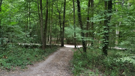
Photo
Where is located Forêt Régionale de Bondy
Forêt Régionale de Bondy — local attraction, which is located at no data and belongs to the category — -. Average visitor rating for this place — 4.3 (according to 26 ratings, information from open sources and relevant for 2022).
Exact location — Forêt Régionale de Bondy, marked on the map with a red marker.
You can get directions to Forêt Régionale de Bondy on the map from your location.
What else is interesting in Livry-Gargan? You can see all the sights if you go to the city page.
Coordinates
Forêt Régionale de Bondy, France coordinates in decimal format: latitude — 48.910300068807025, longitude — 2.563155885522025. When converted to degrees, minutes, seconds Forêt Régionale de Bondy has the following coordinates: 48°54′37.08 north latitude and 2°33′47.36 east longitude.
Nearby cities
The largest cities that are located nearby:
- Boulogne-Billancourt — 23 km
- Amiens — 109 km
- Reims — 114 km
- Rouen — 118 km
- Orléans — 122 km
- Le Havre — 186 km
- Lille — 193 km
- Le Mans — 200 km
- Caen — 212 km
- Charleroi
 (Belgium) — 213 km
 - Tours — 218 km
- Namur (Belgium) — 237 km
- Brussels (Belgium) — 248 km
- Dijon — 258 km
- Eastbourne
 (United Kingdom) — 258 km
 - Metz — 264 km
- Nancy — 267 km
- Angers — 281 km
- Antwerp (Belgium) — 285 km
Distance to the capital
Distance to the capital (Paris) is about — 17 km.