
 Maureville
Samoëns
Gréning
Toulouse
Volx
Goudet
Méhoncourt
Saint-Hymer
Pontcarré
Maureville
Samoëns
Gréning
Toulouse
Volx
Goudet
Méhoncourt
Saint-Hymer
Pontcarré
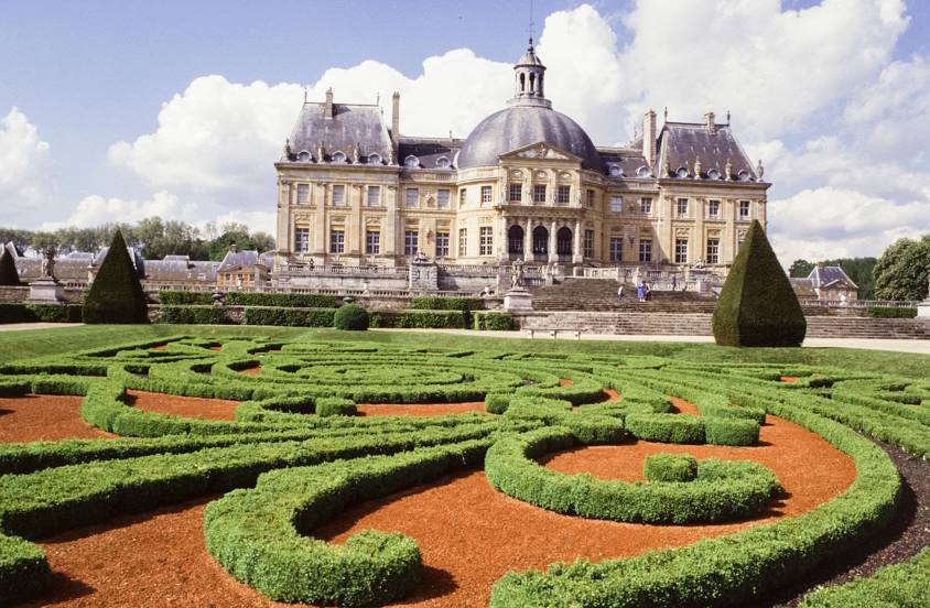
Gardens of Vaux le Vicomte Castle on the map, Fontainebleau, France
Photo
Where is located Gardens of Vaux le Vicomte Castle
Gardens of Vaux le Vicomte Castle — local attraction, which is located at Château de Vaux-le-Vicomte, 77950 Maincy, France and belongs to the category — garden. Average visitor rating for this place — 4.6 (according to 5187 ratings, information from open sources and relevant for 2022).
Exact location — Gardens of Vaux le Vicomte Castle, marked on the map with a red marker.
You can get directions to Gardens of Vaux le Vicomte Castle on the map from your location.
What else is interesting in Fontainebleau? You can see all the sights if you go to the city page.
Coordinates
Gardens of Vaux le Vicomte Castle, France coordinates in decimal format: latitude — 48.56549682951485, longitude — 2.7141683480305474. When converted to degrees, minutes, seconds Gardens of Vaux le Vicomte Castle has the following coordinates: 48°33′55.79 north latitude and 2°42′51.01 east longitude.
Nearby cities
The largest cities that are located nearby:
- Boulogne-Billancourt — 59 km
- Orléans — 81 km
- Reims — 135 km
- Rouen — 163 km
- Amiens — 167 km
- Tours — 188 km
- Le Mans — 190 km
- Dijon — 212 km
- Le Havre — 222 km
- Caen — 238 km
- Lille — 247 km
- Charleroi
 (Belgium) — 254 km
 - Nancy — 256 km
- Metz — 264 km
- Angers — 265 km
- Namur (Belgium) — 274 km
- Besançon — 281 km
- Clermont-Ferrand — 292 km
- Brussels (Belgium) — 294 km
Distance to the capital
Distance to the capital (Paris) is about — 42 km.