
 Maureville
Samoëns
Gréning
Toulouse
Volx
Goudet
Méhoncourt
Saint-Hymer
Pontcarré
Maureville
Samoëns
Gréning
Toulouse
Volx
Goudet
Méhoncourt
Saint-Hymer
Pontcarré
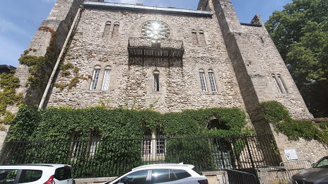
Donjon de Moret-sur-Loing on the map, Fontainebleau, France
Photo
Where is located Donjon de Moret-sur-Loing
Donjon de Moret-sur-Loing — local attraction, which is located at 15 Rue du Donjon, 77250 Moret-sur-Loing, France and belongs to the category — historical landmark. Average visitor rating for this place — 4.3 (according to 158 ratings, information from open sources and relevant for 2022).
Exact location — Donjon de Moret-sur-Loing, marked on the map with a red marker.
You can get directions to Donjon de Moret-sur-Loing on the map from your location.
What else is interesting in Fontainebleau? You can see all the sights if you go to the city page.
Coordinates
Donjon de Moret-sur-Loing, France coordinates in decimal format: latitude — 48.3707594430107, longitude — 2.818956798023713. When converted to degrees, minutes, seconds Donjon de Moret-sur-Loing has the following coordinates: 48°22′14.73 north latitude and 2°49′8.24 east longitude.
Nearby cities
The largest cities that are located nearby:
- Boulogne-Billancourt — 59 km
- Orléans — 81 km
- Reims — 135 km
- Rouen — 163 km
- Amiens — 167 km
- Tours — 188 km
- Le Mans — 190 km
- Dijon — 212 km
- Le Havre — 222 km
- Caen — 238 km
- Lille — 247 km
- Charleroi
 (Belgium) — 254 km
 - Nancy — 256 km
- Metz — 264 km
- Angers — 265 km
- Namur (Belgium) — 274 km
- Besançon — 281 km
- Clermont-Ferrand — 292 km
- Brussels (Belgium) — 294 km
Distance to the capital
Distance to the capital (Paris) is about — 64 km.