
 Maureville
Samoëns
Gréning
Toulouse
Volx
Goudet
Méhoncourt
Saint-Hymer
Pontcarré
Maureville
Samoëns
Gréning
Toulouse
Volx
Goudet
Méhoncourt
Saint-Hymer
Pontcarré
Parc Montreau on the map, Montreuil, France
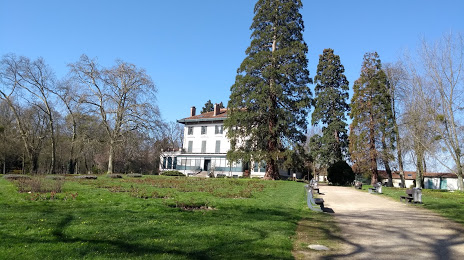
Photo
Where is located Parc Montreau
Parc Montreau — local attraction, which is located at 33 Bd Théophile Sueur, 93100 Montreuil, France and belongs to the category — park. Average visitor rating for this place — 4.2 (according to 1512 ratings, information from open sources and relevant for 2022).
Exact location — Parc Montreau, marked on the map with a red marker.
You can get directions to Parc Montreau on the map from your location.
What else is interesting in Montreuil? You can see all the sights if you go to the city page.
Coordinates
Parc Montreau, France coordinates in decimal format: latitude — 48.86547829059519, longitude — 2.4725997980411356. When converted to degrees, minutes, seconds Parc Montreau has the following coordinates: 48°51′55.72 north latitude and 2°28′21.36 east longitude.
Nearby cities
The largest cities that are located nearby:
- Boulogne-Billancourt — 15 km
- Orléans — 113 km
- Amiens — 114 km
- Rouen — 116 km
- Reims — 122 km
- Le Havre — 182 km
- Le Mans — 191 km
- Lille — 200 km
- Caen — 207 km
- Tours — 209 km
- Charleroi
 (Belgium) — 221 km
 - Namur (Belgium) — 246 km
- Brussels (Belgium) — 257 km
- Dijon — 259 km
- Eastbourne
 (United Kingdom) — 259 km
 - Metz — 271 km
- Angers — 272 km
- Nancy — 273 km
- Antwerp (Belgium) — 293 km
Distance to the capital
Distance to the capital (Paris) is about — 9 km.