
 Maureville
Samoëns
Gréning
Toulouse
Volx
Goudet
Méhoncourt
Saint-Hymer
Pontcarré
Maureville
Samoëns
Gréning
Toulouse
Volx
Goudet
Méhoncourt
Saint-Hymer
Pontcarré
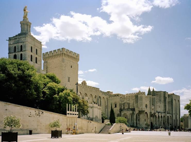
Palais des Papes on the map, Avignon, France
Photo
Where is located Palais des Papes
Palais des Papes — local attraction, which is located at Pl. du Palais, 84000 Avignon, France and belongs to the category — palace. Average visitor rating for this place — 4.5 (according to 29981 rating, information from open sources and relevant for 2022).
Exact location — Palais des Papes, marked on the map with a red marker.
You can get directions to Palais des Papes on the map from your location.
What else is interesting in Avignon? You can see all the sights if you go to the city page.
Coordinates
Palais des Papes, France coordinates in decimal format: latitude — 43.9508134587555, longitude — 4.807697097873945. When converted to degrees, minutes, seconds Palais des Papes has the following coordinates: 43°57′2.93 north latitude and 4°48′27.71 east longitude.
Nearby cities
The largest cities that are located nearby:
- Nimes — 38 km
- Aix-en-Provence — 69 km
- Montpellier — 83 km
- Marseille — 85 km
- Toulon — 129 km
- Grenoble — 155 km
- Saint-Étienne — 168 km
- Nice — 198 km
- Lyon — 201 km
- Villeurbanne — 202 km
- Perpignan — 209 km
- Clermont-Ferrand — 242 km
- Turin
 (Italy) — 257 km
 - Geneva
 (Switzerland) — 269 km
 - Toulouse — 272 km
- Lausanne (Switzerland) — 316 km
- Mataró
 (Spain) — 331 km
 - Genoa (Italy) — 331 km
- Novara (Italy) — 339 km
Distance to the capital
Distance to the capital (Paris) is about — 577 km.