
 Maureville
Samoëns
Gréning
Toulouse
Volx
Goudet
Méhoncourt
Saint-Hymer
Pontcarré
Maureville
Samoëns
Gréning
Toulouse
Volx
Goudet
Méhoncourt
Saint-Hymer
Pontcarré
Parc du Louvre Lens on the map, Lens, France
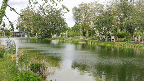
Photo
Where is located Parc du Louvre Lens
Parc du Louvre Lens — local attraction, which is located at 62300 Liévin, France and belongs to the category — garden. Average visitor rating for this place — 5.0 (according to 1 rating, information from open sources and relevant for 2022).
Exact location — Parc du Louvre Lens, marked on the map with a red marker.
You can get directions to Parc du Louvre Lens on the map from your location.
What else is interesting in Lens? You can see all the sights if you go to the city page.
Coordinates
Parc du Louvre Lens, France coordinates in decimal format: latitude — 50.43062620749707, longitude — 2.802543998097186. When converted to degrees, minutes, seconds Parc du Louvre Lens has the following coordinates: 50°25′50.25 north latitude and 2°48′9.16 east longitude.
Nearby cities
The largest cities that are located nearby:
- Lille — 27 km
- Amiens — 70 km
- Charleroi
 (Belgium) — 114 km
 - Brussels (Belgium) — 116 km
- Antwerp (Belgium) — 140 km
- Namur (Belgium) — 144 km
- Reims — 156 km
- Rouen — 165 km
- Boulogne-Billancourt — 181 km
- Eastbourne
 (United Kingdom) — 182 km
 - Breda
 (Netherlands) — 185 km
 - Gillingham (United Kingdom) — 190 km
- Southend-on-Sea (United Kingdom) — 191 km
- Liège (Belgium) — 194 km
- Dordrecht (Netherlands) — 199 km
- Tilburg (Netherlands) — 199 km
- Rotterdam (Netherlands) — 200 km
- Basildon (United Kingdom) — 205 km
- Maastricht (Netherlands) — 205 km
Distance to the capital
Distance to the capital (Paris) is about — 178 km.