
 Maureville
Samoëns
Gréning
Toulouse
Volx
Goudet
Méhoncourt
Saint-Hymer
Pontcarré
Maureville
Samoëns
Gréning
Toulouse
Volx
Goudet
Méhoncourt
Saint-Hymer
Pontcarré
Musée de Saint-Chef on the map, Bourgoin-Jallieu, France
Photo
Where is located Musée de Saint-Chef
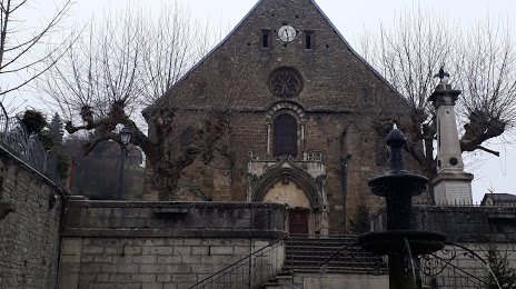
Musée de Saint-Chef — local attraction, which is located at 2 Rue du Seigneur de By, 38890 Saint-Chef, France and belongs to the category — museum. Average visitor rating for this place — 5.0 (according to 6 ratings, information from open sources and relevant for 2022).
Exact location — Musée de Saint-Chef, marked on the map with a red marker.
You can get directions to Musée de Saint-Chef on the map from your location.
What else is interesting in Bourgoin-Jallieu? You can see all the sights if you go to the city page.
Coordinates
Musée de Saint-Chef, France coordinates in decimal format: latitude — 45.634693169464654, longitude — 5.365834497929685. When converted to degrees, minutes, seconds Musée de Saint-Chef has the following coordinates: 45°38′4.9 north latitude and 5°21′57 east longitude.
Nearby cities
The largest cities that are located nearby:
- Villeurbanne — 35 km
- Lyon — 38 km
- Grenoble — 57 km
- Saint-Étienne — 71 km
- Geneva
 (Switzerland) — 94 km
 - Lausanne (Switzerland) — 145 km
- Clermont-Ferrand — 170 km
- Besançon — 190 km
- Dijon — 191 km
- Turin
 (Italy) — 197 km
 - Nimes — 208 km
- Bern (Switzerland) — 222 km
- Aix-en-Provence — 229 km
- Montpellier — 246 km
- Marseille — 254 km
- Novara (Italy) — 260 km
- Nice — 262 km
- Toulon — 278 km
- Basel (Switzerland) — 278 km
Distance to the capital
Distance to the capital (Paris) is about — 424 km.