
 Maureville
Samoëns
Gréning
Toulouse
Volx
Goudet
Méhoncourt
Saint-Hymer
Pontcarré
Maureville
Samoëns
Gréning
Toulouse
Volx
Goudet
Méhoncourt
Saint-Hymer
Pontcarré
Manège royal on the map, Montesson, France
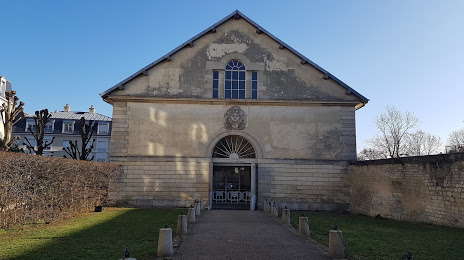
Photo
Where is located Manège royal
Manège royal — local attraction, which is located at 78100 Saint-Germain-en-Laye, France and belongs to the category — historical landmark. Average visitor rating for this place — 4.4 (according to 63 ratings, information from open sources and relevant for 2022).
Exact location — Manège royal, marked on the map with a red marker.
You can get directions to Manège royal on the map from your location.
What else is interesting in Montesson? You can see all the sights if you go to the city page.
Coordinates
Manège royal, France coordinates in decimal format: latitude — 48.8947499112441, longitude — 2.0990628980421864. When converted to degrees, minutes, seconds Manège royal has the following coordinates: 48°53′41.1 north latitude and 2°5′56.63 east longitude.
Nearby cities
The largest cities that are located nearby:
- Boulogne-Billancourt — 10 km
- Rouen — 96 km
- Amiens — 109 km
- Orléans — 113 km
- Reims — 141 km
- Le Havre — 160 km
- Le Mans — 175 km
- Caen — 185 km
- Tours — 200 km
- Lille — 201 km
- Charleroi
 (Belgium) — 232 km
 - Eastbourne
 (United Kingdom) — 243 km
 - Angers — 257 km
- Namur (Belgium) — 258 km
- Brussels (Belgium) — 264 km
- Dijon — 279 km
- Metz — 292 km
- Crawley (United Kingdom) — 292 km
- Gillingham (United Kingdom) — 295 km
Distance to the capital
Distance to the capital (Paris) is about — 19 km.