
 Maureville
Samoëns
Gréning
Toulouse
Volx
Goudet
Méhoncourt
Saint-Hymer
Pontcarré
Maureville
Samoëns
Gréning
Toulouse
Volx
Goudet
Méhoncourt
Saint-Hymer
Pontcarré
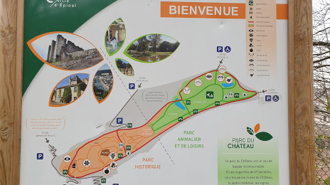
Parc du château on the map, Épinal, France
Photo
Where is located Parc du château
Parc du château — local attraction, which is located at 26 Rue Saint-Michel, 88000 Épinal, France and belongs to the category — castle. Average visitor rating for this place — 4.4 (according to 922 ratings, information from open sources and relevant for 2022).
Exact location — Parc du château, marked on the map with a red marker.
You can get directions to Parc du château on the map from your location.
What else is interesting in Épinal? You can see all the sights if you go to the city page.
Coordinates
Parc du château, France coordinates in decimal format: latitude — 48.17500170620719, longitude — 6.455193998016845. When converted to degrees, minutes, seconds Parc du château has the following coordinates: 48°10′30.01 north latitude and 6°27′18.7 east longitude.
Nearby cities
The largest cities that are located nearby:
- Nancy — 61 km
- Mulhouse — 81 km
- Freiburg
 (Germany) — 105 km
 - Strasbourg — 105 km
- Metz — 107 km
- Besançon — 108 km
- Basel
 (Switzerland) — 109 km
 - Saarbrücken (Germany) — 124 km
- Dijon — 141 km
- Bern (Switzerland) — 155 km
- Karlsruhe (Germany) — 169 km
- Trier (Germany) — 175 km
- Zurich (Switzerland) — 180 km
- Pforzheim (Germany) — 182 km
- Lausanne (Switzerland) — 183 km
- Ludwigshafen (Germany) — 203 km
- Reutlingen (Germany) — 205 km
- Mannheim (Germany) — 205 km
- Heidelberg (Germany) — 210 km
Distance to the capital
Distance to the capital (Paris) is about — 312 km.