
 Maureville
Samoëns
Gréning
Toulouse
Volx
Goudet
Méhoncourt
Saint-Hymer
Pontcarré
Maureville
Samoëns
Gréning
Toulouse
Volx
Goudet
Méhoncourt
Saint-Hymer
Pontcarré
Château de Saint-Germain-de-Livet on the map, Lisieux, France
Photo
Where is located Château de Saint-Germain-de-Livet
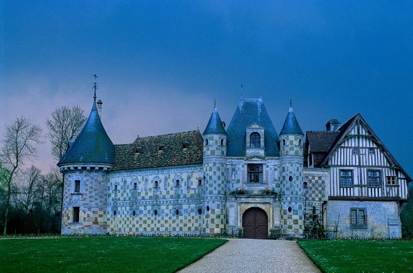
Château de Saint-Germain-de-Livet — local attraction, which is located at D268, 14100 Saint-Germain-de-Livet, France and belongs to the category — castle. Average visitor rating for this place — 4.5 (according to 407 ratings, information from open sources and relevant for 2022).
Exact location — Château de Saint-Germain-de-Livet, marked on the map with a red marker.
You can get directions to Château de Saint-Germain-de-Livet on the map from your location.
What else is interesting in Lisieux? You can see all the sights if you go to the city page.
Coordinates
Château de Saint-Germain-de-Livet, France coordinates in decimal format: latitude — 49.08914434860798, longitude — 0.21452839804907198. When converted to degrees, minutes, seconds Château de Saint-Germain-de-Livet has the following coordinates: 49°5′20.92 north latitude and 0°12′52.3 east longitude.
Nearby cities
The largest cities that are located nearby:
- Le Havre — 39 km
- Caen — 43 km
- Rouen — 71 km
- Le Mans — 126 km
- Boulogne-Billancourt — 150 km
- Amiens — 169 km
- Eastbourne
 (United Kingdom) — 179 km
 - Rennes — 181 km
- Orléans — 186 km
- Angers — 194 km
- Tours — 197 km
- Portsmouth (United Kingdom) — 207 km
- Crawley (United Kingdom) — 219 km
- Southampton (United Kingdom) — 226 km
- Bournemouth (United Kingdom) — 228 km
- Sutton (United Kingdom) — 247 km
- Gillingham (United Kingdom) — 249 km
- Nantes — 252 km
- Lille — 257 km
Distance to the capital
Distance to the capital (Paris) is about — 158 km.