
 Maureville
Samoëns
Gréning
Toulouse
Volx
Goudet
Méhoncourt
Saint-Hymer
Pontcarré
Maureville
Samoëns
Gréning
Toulouse
Volx
Goudet
Méhoncourt
Saint-Hymer
Pontcarré
Cathédrale Saint-Étienne d'Auxerre on the map, Auxerre, France
Photo
Where is located Cathédrale Saint-Étienne d'Auxerre
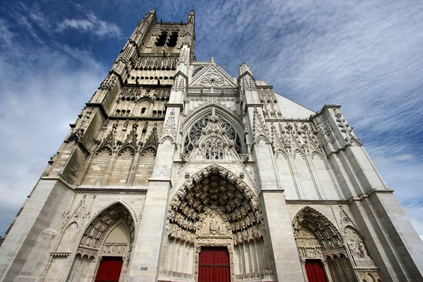
Cathédrale Saint-Étienne d'Auxerre — local attraction, which is located at Pl. Saint-Étienne, 89000 Auxerre, France and belongs to the category — cathedral. Average visitor rating for this place — 4.5 (according to 1027 ratings, information from open sources and relevant for 2022).
Exact location — Cathédrale Saint-Étienne d'Auxerre, marked on the map with a red marker.
You can get directions to Cathédrale Saint-Étienne d'Auxerre on the map from your location.
What else is interesting in Auxerre? You can see all the sights if you go to the city page.
Coordinates
Cathédrale Saint-Étienne d'Auxerre, France coordinates in decimal format: latitude — 47.79778694377567, longitude — 3.5731070980036663. When converted to degrees, minutes, seconds Cathédrale Saint-Étienne d'Auxerre has the following coordinates: 47°47′52.03 north latitude and 3°34′23.19 east longitude.
Nearby cities
The largest cities that are located nearby:
- Dijon — 122 km
- Orléans — 124 km
- Boulogne-Billancourt — 151 km
- Reims — 165 km
- Besançon — 194 km
- Nancy — 215 km
- Tours — 221 km
- Clermont-Ferrand — 227 km
- Metz — 238 km
- Lyon — 245 km
- Villeurbanne — 246 km
- Amiens — 249 km
- Le Mans — 251 km
- Rouen — 254 km
- Geneva
 (Switzerland) — 264 km
 - Saint-Étienne — 268 km
- Lausanne (Switzerland) — 272 km
- Mulhouse — 280 km
- Limoges — 281 km
Distance to the capital
Distance to the capital (Paris) is about — 148 km.