
 Maureville
Samoëns
Gréning
Toulouse
Volx
Goudet
Méhoncourt
Saint-Hymer
Pontcarré
Maureville
Samoëns
Gréning
Toulouse
Volx
Goudet
Méhoncourt
Saint-Hymer
Pontcarré
La Tour de l'Horloge on the map, Auxerre, France
Photo
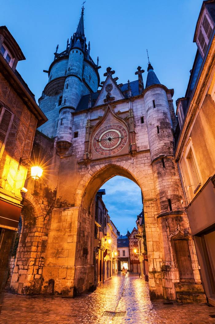
Where is located La Tour de l'Horloge
La Tour de l'Horloge — local attraction, which is located at Rue de la Draperie, 89000 Auxerre, France and belongs to the category — historical landmark. Average visitor rating for this place — 4.2 (according to 535 ratings, information from open sources and relevant for 2022).
Exact location — La Tour de l'Horloge, marked on the map with a red marker.
You can get directions to La Tour de l'Horloge on the map from your location.
What else is interesting in Auxerre? You can see all the sights if you go to the city page.
Coordinates
La Tour de l'Horloge, France coordinates in decimal format: latitude — 47.795883642455514, longitude — 3.5698561980036017. When converted to degrees, minutes, seconds La Tour de l'Horloge has the following coordinates: 47°47′45.18 north latitude and 3°34′11.48 east longitude.
Nearby cities
The largest cities that are located nearby:
- Dijon — 122 km
- Orléans — 124 km
- Boulogne-Billancourt — 151 km
- Reims — 165 km
- Besançon — 194 km
- Nancy — 215 km
- Tours — 221 km
- Clermont-Ferrand — 227 km
- Metz — 238 km
- Lyon — 245 km
- Villeurbanne — 246 km
- Amiens — 249 km
- Le Mans — 251 km
- Rouen — 254 km
- Geneva
 (Switzerland) — 264 km
 - Saint-Étienne — 268 km
- Lausanne (Switzerland) — 272 km
- Mulhouse — 280 km
- Limoges — 281 km
Distance to the capital
Distance to the capital (Paris) is about — 148 km.