
 Maureville
Samoëns
Gréning
Toulouse
Volx
Goudet
Méhoncourt
Saint-Hymer
Pontcarré
Maureville
Samoëns
Gréning
Toulouse
Volx
Goudet
Méhoncourt
Saint-Hymer
Pontcarré
Parc forestier de la Poudrerie on the map, Villepinte, France
Photo
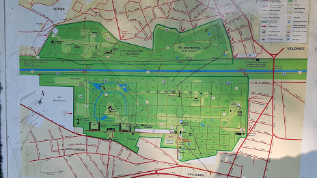
Where is located Parc forestier de la Poudrerie
Parc forestier de la Poudrerie — local attraction, which is located at All. Eugène Burlot, 93410 Vaujours, France and belongs to the category — park. Average visitor rating for this place — 4.4 (according to 1907 ratings, information from open sources and relevant for 2022).
Exact location — Parc forestier de la Poudrerie, marked on the map with a red marker.
You can get directions to Parc forestier de la Poudrerie on the map from your location.
What else is interesting in Villepinte? You can see all the sights if you go to the city page.
Coordinates
Parc forestier de la Poudrerie, France coordinates in decimal format: latitude — 48.93868274225252, longitude — 2.5579174980437385. When converted to degrees, minutes, seconds Parc forestier de la Poudrerie has the following coordinates: 48°56′19.26 north latitude and 2°33′28.5 east longitude.
Nearby cities
The largest cities that are located nearby:
- Boulogne-Billancourt — 26 km
- Amiens — 105 km
- Reims — 112 km
- Rouen — 117 km
- Orléans — 126 km
- Le Havre — 185 km
- Lille — 188 km
- Le Mans — 203 km
- Charleroi
 (Belgium) — 209 km
 - Caen — 212 km
- Tours — 222 km
- Namur (Belgium) — 234 km
- Brussels (Belgium) — 244 km
- Eastbourne
 (United Kingdom) — 254 km
 - Dijon — 261 km
- Metz — 263 km
- Nancy — 267 km
- Antwerp (Belgium) — 281 km
- Liège (Belgium) — 282 km
Distance to the capital
Distance to the capital (Paris) is about — 18 km.