
 Maureville
Samoëns
Gréning
Toulouse
Volx
Goudet
Méhoncourt
Saint-Hymer
Pontcarré
Maureville
Samoëns
Gréning
Toulouse
Volx
Goudet
Méhoncourt
Saint-Hymer
Pontcarré
Parc Botanique de Haute Bretagne on the map, Fougères, France
Photo
Where is located Parc Botanique de Haute Bretagne
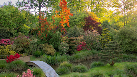
Parc Botanique de Haute Bretagne — local attraction, which is located at La Folletière, 35133 Le Chatellier, France and belongs to the category — botanical garden. Average visitor rating for this place — 4.5 (according to 876 ratings, information from open sources and relevant for 2022).
Exact location — Parc Botanique de Haute Bretagne, marked on the map with a red marker.
You can get directions to Parc Botanique de Haute Bretagne on the map from your location.
What else is interesting in Fougères? You can see all the sights if you go to the city page.
Coordinates
Parc Botanique de Haute Bretagne, France coordinates in decimal format: latitude — 48.42976298432653, longitude — -1.2607241019742146. When converted to degrees, minutes, seconds Parc Botanique de Haute Bretagne has the following coordinates: 48°25′47.15 north latitude and -1°15′38.61 east longitude.
Nearby cities
The largest cities that are located nearby:
- Rennes — 43 km
- Angers — 108 km
- Caen — 110 km
- Le Mans — 111 km
- Nantes — 128 km
- Le Havre — 158 km
- Tours — 177 km
- Rouen — 205 km
- Orléans — 236 km
- Brest — 241 km
- Boulogne-Billancourt — 256 km
- Bournemouth
 (United Kingdom) — 266 km
 - Portsmouth (United Kingdom) — 273 km
- Southampton (United Kingdom) — 283 km
- Eastbourne (United Kingdom) — 287 km
- Amiens — 302 km
- Exeter (United Kingdom) — 308 km
- Crawley (United Kingdom) — 313 km
- Limoges — 337 km
Distance to the capital
Distance to the capital (Paris) is about — 270 km.