
 Maureville
Samoëns
Gréning
Toulouse
Volx
Goudet
Méhoncourt
Saint-Hymer
Pontcarré
Maureville
Samoëns
Gréning
Toulouse
Volx
Goudet
Méhoncourt
Saint-Hymer
Pontcarré
Château de Chantilly on the map, Senlis, France
Photo
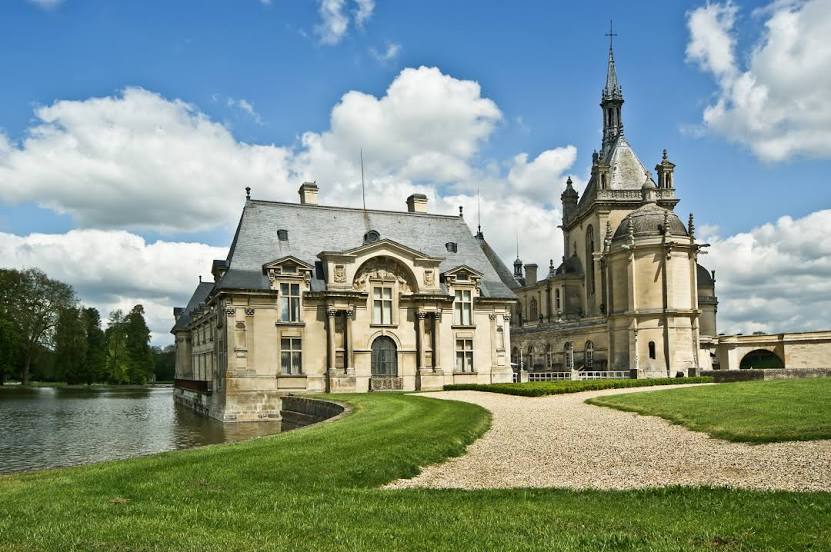
Where is located Château de Chantilly
Château de Chantilly — local attraction, which is located at 60500 Chantilly, France and belongs to the category — art gallery. Average visitor rating for this place — 4.6 (according to 10619 ratings, information from open sources and relevant for 2022).
Exact location — Château de Chantilly, marked on the map with a red marker.
You can get directions to Château de Chantilly on the map from your location.
What else is interesting in Senlis? You can see all the sights if you go to the city page.
Coordinates
Château de Chantilly, France coordinates in decimal format: latitude — 49.19381162273647, longitude — 2.485203398052818. When converted to degrees, minutes, seconds Château de Chantilly has the following coordinates: 49°11′37.72 north latitude and 2°29′6.73 east longitude.
Nearby cities
The largest cities that are located nearby:
- Boulogne-Billancourt — 48 km
- Amiens — 79 km
- Reims — 105 km
- Rouen — 110 km
- Orléans — 152 km
- Lille — 161 km
- Le Havre — 181 km
- Charleroi
 (Belgium) — 187 km
 - Namur (Belgium) — 213 km
- Caen — 213 km
- Brussels (Belgium) — 220 km
- Le Mans — 221 km
- Eastbourne
 (United Kingdom) — 236 km
 - Tours — 246 km
- Antwerp (Belgium) — 256 km
- Metz — 260 km
- Liège (Belgium) — 263 km
- Nancy — 269 km
- Dijon — 278 km
Distance to the capital
Distance to the capital (Paris) is about — 39 km.