
 Maureville
Samoëns
Gréning
Toulouse
Volx
Goudet
Méhoncourt
Saint-Hymer
Pontcarré
Maureville
Samoëns
Gréning
Toulouse
Volx
Goudet
Méhoncourt
Saint-Hymer
Pontcarré
Forêt de Ripaille on the map, Thonon-les-Bains, France
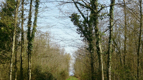
Photo
Where is located Forêt de Ripaille
Forêt de Ripaille — local attraction, which is located at 10 Chem. de la Forêt, 74200 Thonon-les-Bains, France and belongs to the category — national forest. Average visitor rating for this place — 4.4 (according to 255 ratings, information from open sources and relevant for 2022).
Exact location — Forêt de Ripaille, marked on the map with a red marker.
You can get directions to Forêt de Ripaille on the map from your location.
What else is interesting in Thonon-les-Bains? You can see all the sights if you go to the city page.
Coordinates
Forêt de Ripaille, France coordinates in decimal format: latitude — 46.38840837720229, longitude — 6.492343197955164. When converted to degrees, minutes, seconds Forêt de Ripaille has the following coordinates: 46°23′18.27 north latitude and 6°29′32.44 east longitude.
Nearby cities
The largest cities that are located nearby:
- Lausanne
 (Switzerland) — 20 km
 - Geneva (Switzerland) — 32 km
- Bern (Switzerland) — 97 km
- Besançon — 101 km
- Villeurbanne — 139 km
- Lyon — 143 km
- Grenoble — 144 km
- Dijon — 150 km
- Basel (Switzerland) — 156 km
- Mulhouse — 165 km
- Turin
 (Italy) — 172 km
 - Zurich (Switzerland) — 190 km
- Saint-Étienne — 192 km
- Novara (Italy) — 195 km
- Freiburg
 (Germany) — 206 km
 - Milan (Italy) — 233 km
- Monza (Italy) — 233 km
- Nancy — 257 km
- Bergamo (Italy) — 258 km
Distance to the capital
Distance to the capital (Paris) is about — 414 km.