
 Maureville
Samoëns
Gréning
Toulouse
Volx
Goudet
Méhoncourt
Saint-Hymer
Pontcarré
Maureville
Samoëns
Gréning
Toulouse
Volx
Goudet
Méhoncourt
Saint-Hymer
Pontcarré
Park grass People (Parc du Peuple de l'herbe) on the map, Poissy, France
Photo
Where is located Park grass People (Parc du Peuple de l'herbe)
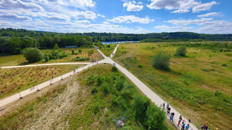
Park grass People (Parc du Peuple de l'herbe) — local attraction, which is located at 718 Av. du Dr Marceltouboul, 78955 Carrières-sous-Poissy, France and belongs to the category — park. Average visitor rating for this place — 4.2 (according to 402 ratings, information from open sources and relevant for 2022).
Exact location — Park grass People (Parc du Peuple de l'herbe), marked on the map with a red marker.
You can get directions to Park grass People (Parc du Peuple de l'herbe) on the map from your location.
What else is interesting in Poissy? You can see all the sights if you go to the city page.
Coordinates
Park grass People (Parc du Peuple de l'herbe), France coordinates in decimal format: latitude — 48.93573444017086, longitude — 2.0145379980436307. When converted to degrees, minutes, seconds Park grass People (Parc du Peuple de l'herbe) has the following coordinates: 48°56′8.64 north latitude and 2°0′52.34 east longitude.
Nearby cities
The largest cities that are located nearby:
- Boulogne-Billancourt — 17 km
- Rouen — 89 km
- Amiens — 108 km
- Orléans — 114 km
- Reims — 148 km
- Le Havre — 153 km
- Le Mans — 171 km
- Caen — 177 km
- Tours — 198 km
- Lille — 201 km
- Charleroi
 (Belgium) — 235 km
 - Eastbourne
 (United Kingdom) — 237 km
 - Angers — 253 km
- Namur (Belgium) — 262 km
- Brussels (Belgium) — 266 km
- Dijon — 286 km
- Crawley (United Kingdom) — 287 km
- Rennes — 289 km
- Gillingham (United Kingdom) — 291 km
Distance to the capital
Distance to the capital (Paris) is about — 26 km.