
 Maureville
Samoëns
Gréning
Toulouse
Volx
Goudet
Méhoncourt
Saint-Hymer
Pontcarré
Maureville
Samoëns
Gréning
Toulouse
Volx
Goudet
Méhoncourt
Saint-Hymer
Pontcarré
Chapelle des Templiers (Commanderie de Laon) on the map, Laon, France
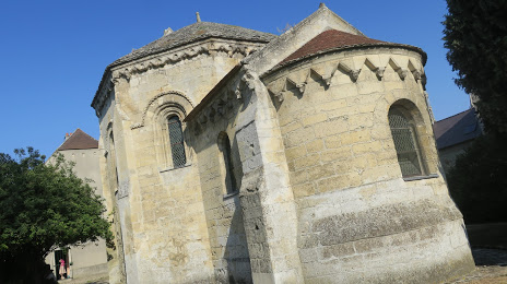
Photo
Where is located Chapelle des Templiers (Commanderie de Laon)
Chapelle des Templiers (Commanderie de Laon) — local attraction, which is located at 32 Rue Georges Ermant, 02000 Laon, France and belongs to the category — tourist attraction. Average visitor rating for this place — 4.1 (according to 57 ratings, information from open sources and relevant for 2022).
Exact location — Chapelle des Templiers (Commanderie de Laon), marked on the map with a red marker.
You can get directions to Chapelle des Templiers (Commanderie de Laon) on the map from your location.
What else is interesting in Laon? You can see all the sights if you go to the city page.
Coordinates
Chapelle des Templiers (Commanderie de Laon), France coordinates in decimal format: latitude — 49.562952485107246, longitude — 3.6271320980659585. When converted to degrees, minutes, seconds Chapelle des Templiers (Commanderie de Laon) has the following coordinates: 49°33′46.63 north latitude and 3°37′37.68 east longitude.
Nearby cities
The largest cities that are located nearby:
- Reims — 45 km
- Amiens — 101 km
- Charleroi
 (Belgium) — 110 km
 - Lille — 124 km
- Boulogne-Billancourt — 128 km
- Namur (Belgium) — 133 km
- Brussels (Belgium) — 151 km
- Liège (Belgium) — 181 km
- Rouen — 182 km
- Antwerp (Belgium) — 191 km
- Metz — 191 km
- Maastricht
 (Netherlands) — 203 km
 - Nancy — 211 km
- Trier
 (Germany) — 217 km
 - Aachen (Germany) — 218 km
- Orléans — 223 km
- Breda (Netherlands) — 237 km
- Tilburg (Netherlands) — 243 km
- Eindhoven (Netherlands) — 244 km
Distance to the capital
Distance to the capital (Paris) is about — 121 km.