
 Maureville
Samoëns
Gréning
Toulouse
Volx
Goudet
Méhoncourt
Saint-Hymer
Pontcarré
Maureville
Samoëns
Gréning
Toulouse
Volx
Goudet
Méhoncourt
Saint-Hymer
Pontcarré
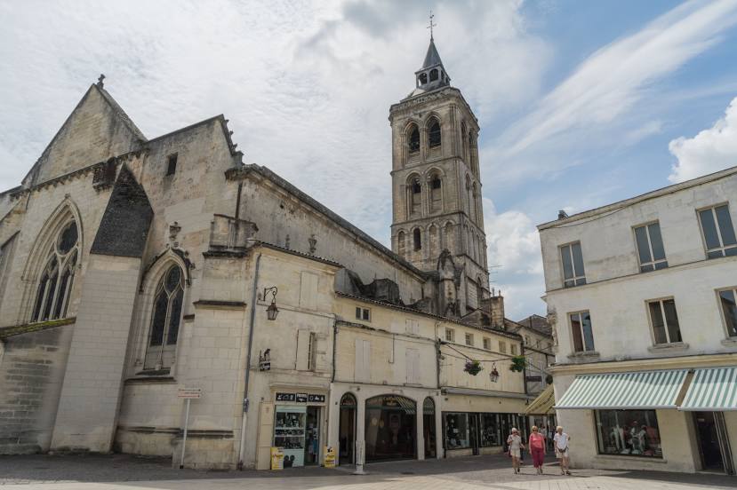
Eglise Saint Léger on the map, Cognac, France
Photo
Where is located Eglise Saint Léger
Eglise Saint Léger — local attraction, which is located at Rue Aristide Briand, 16100 Cognac, France and belongs to the category — catholic church. Average visitor rating for this place — 4.3 (according to 294 ratings, information from open sources and relevant for 2022).
Exact location — Eglise Saint Léger, marked on the map with a red marker.
You can get directions to Eglise Saint Léger on the map from your location.
What else is interesting in Cognac? You can see all the sights if you go to the city page.
Coordinates
Eglise Saint Léger, France coordinates in decimal format: latitude — 45.695169309965216, longitude — -0.32861490206828814. When converted to degrees, minutes, seconds Eglise Saint Léger has the following coordinates: 45°41′42.61 north latitude and -0°19′43.01 east longitude.
Nearby cities
The largest cities that are located nearby:
- Bordeaux — 96 km
- Limoges — 123 km
- Nantes — 192 km
- Angers — 198 km
- Tours — 203 km
- Le Mans — 259 km
- Clermont-Ferrand — 264 km
- Toulouse — 271 km
- Rennes — 286 km
- San Sebastián
 (Spain) — 294 km
 - Orléans — 296 km
- Pamplona (Spain) — 336 km
- Bilbao (Spain) — 341 km
- Vitoria-Gasteiz (Spain) — 367 km
- Saint-Étienne — 367 km
- Santander (Spain) — 373 km
- Caen — 386 km
- Boulogne-Billancourt — 395 km
- Logroño (Spain) — 396 km
Distance to the capital
Distance to the capital (Paris) is about — 406 km.