
 Maureville
Samoëns
Gréning
Toulouse
Volx
Goudet
Méhoncourt
Saint-Hymer
Pontcarré
Maureville
Samoëns
Gréning
Toulouse
Volx
Goudet
Méhoncourt
Saint-Hymer
Pontcarré
Champagne COLLARD-PICARD on the map, Épernay, France
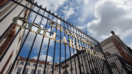
Photo
Where is located Champagne COLLARD-PICARD
Champagne COLLARD-PICARD — local attraction, which is located at 15 Av. de Champagne, 51200 Épernay, France and belongs to the category — vineyard. Average visitor rating for this place — 4.3 (according to 126 ratings, information from open sources and relevant for 2022).
Exact location — Champagne COLLARD-PICARD, marked on the map with a red marker.
You can get directions to Champagne COLLARD-PICARD on the map from your location.
What else is interesting in Épernay? You can see all the sights if you go to the city page.
Coordinates
Champagne COLLARD-PICARD, France coordinates in decimal format: latitude — 49.042813815832666, longitude — 3.9618251980474084. When converted to degrees, minutes, seconds Champagne COLLARD-PICARD has the following coordinates: 49°2′34.13 north latitude and 3°57′42.57 east longitude.
Nearby cities
The largest cities that are located nearby:
- Reims — 24 km
- Boulogne-Billancourt — 127 km
- Amiens — 151 km
- Charleroi
 (Belgium) — 155 km
 - Metz — 161 km
- Nancy — 167 km
- Namur (Belgium) — 170 km
- Lille — 186 km
- Orléans — 197 km
- Brussels (Belgium) — 202 km
- Trier
 (Germany) — 207 km
 - Dijon — 207 km
- Liège (Belgium) — 209 km
- Rouen — 210 km
- Saarbrücken (Germany) — 221 km
- Maastricht
 (Netherlands) — 234 km
 - Aachen (Germany) — 242 km
- Antwerp (Belgium) — 243 km
- Besançon — 253 km
Distance to the capital
Distance to the capital (Paris) is about — 119 km.