
 Maureville
Samoëns
Gréning
Toulouse
Volx
Goudet
Méhoncourt
Saint-Hymer
Pontcarré
Maureville
Samoëns
Gréning
Toulouse
Volx
Goudet
Méhoncourt
Saint-Hymer
Pontcarré
Lilac Park (Parc des Lilas) on the map, Villejuif, France
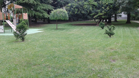
Photo
Where is located Lilac Park (Parc des Lilas)
Lilac Park (Parc des Lilas) — local attraction, which is located at Rue du Dr Antomarchi, 94800 Villejuif, France and belongs to the category — park. Average visitor rating for this place — 4.1 (according to 109 ratings, information from open sources and relevant for 2022).
Exact location — Lilac Park (Parc des Lilas), marked on the map with a red marker.
You can get directions to Lilac Park (Parc des Lilas) on the map from your location.
What else is interesting in Villejuif? You can see all the sights if you go to the city page.
Coordinates
Lilac Park (Parc des Lilas), France coordinates in decimal format: latitude — 48.78167222761908, longitude — 2.3742682209043524. When converted to degrees, minutes, seconds Lilac Park (Parc des Lilas) has the following coordinates: 48°46′54.02 north latitude and 2°22′27.37 east longitude.
Nearby cities
The largest cities that are located nearby:
- Boulogne-Billancourt — 10 km
- Orléans — 104 km
- Rouen — 116 km
- Amiens — 122 km
- Reims — 131 km
- Le Havre — 179 km
- Le Mans — 182 km
- Tours — 199 km
- Caen — 202 km
- Lille — 209 km
- Charleroi
 (Belgium) — 232 km
 - Namur (Belgium) — 256 km
- Dijon — 259 km
- Eastbourne
 (United Kingdom) — 262 km
 - Angers — 262 km
- Brussels (Belgium) — 267 km
- Metz — 279 km
- Nancy — 279 km
- Antwerp (Belgium) — 303 km
Distance to the capital
Distance to the capital (Paris) is about — 8 km.