
 Maureville
Samoëns
Gréning
Toulouse
Volx
Goudet
Méhoncourt
Saint-Hymer
Pontcarré
Maureville
Samoëns
Gréning
Toulouse
Volx
Goudet
Méhoncourt
Saint-Hymer
Pontcarré
Domaine de Montéclin on the map, Saint-Cloud, France
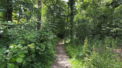
Photo
Where is located Domaine de Montéclin
Domaine de Montéclin — local attraction, which is located at Rd 53, 91570 Bièvres, France and belongs to the category — park. Average visitor rating for this place — 4.2 (according to 45 ratings, information from open sources and relevant for 2022).
Exact location — Domaine de Montéclin, marked on the map with a red marker.
You can get directions to Domaine de Montéclin on the map from your location.
What else is interesting in Saint-Cloud? You can see all the sights if you go to the city page.
Coordinates
Domaine de Montéclin, France coordinates in decimal format: latitude — 48.80793426065264, longitude — 2.1959763919324815. When converted to degrees, minutes, seconds Domaine de Montéclin has the following coordinates: 48°48′28.56 north latitude and 2°11′45.52 east longitude.
Nearby cities
The largest cities that are located nearby:
- Boulogne-Billancourt — 2 km
- Rouen — 103 km
- Orléans — 107 km
- Amiens — 116 km
- Reims — 139 km
- Le Havre — 167 km
- Le Mans — 175 km
- Caen — 190 km
- Tours — 197 km
- Lille — 206 km
- Charleroi
 (Belgium) — 234 km
 - Eastbourne
 (United Kingdom) — 251 km
 - Angers — 257 km
- Namur (Belgium) — 259 km
- Brussels (Belgium) — 267 km
- Dijon — 271 km
- Metz — 289 km
- Nancy — 291 km
- Rennes — 298 km
Distance to the capital
Distance to the capital (Paris) is about — 13 km.