
 Maureville
Samoëns
Gréning
Toulouse
Volx
Goudet
Méhoncourt
Saint-Hymer
Pontcarré
Maureville
Samoëns
Gréning
Toulouse
Volx
Goudet
Méhoncourt
Saint-Hymer
Pontcarré
Lac du Cap de Bos on the map, Pessac, France
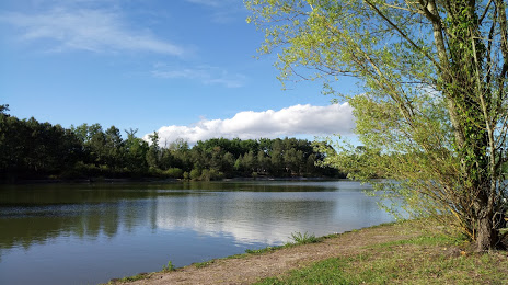
Photo
Where is located Lac du Cap de Bos
Lac du Cap de Bos — local attraction, which is located at no data and belongs to the category — -. Average visitor rating for this place — 4.2 (according to 23 ratings, information from open sources and relevant for 2022).
Exact location — Lac du Cap de Bos, marked on the map with a red marker.
You can get directions to Lac du Cap de Bos on the map from your location.
What else is interesting in Pessac? You can see all the sights if you go to the city page.
Coordinates
Lac du Cap de Bos, France coordinates in decimal format: latitude — 44.79572066194845, longitude — -0.6879276020983099. When converted to degrees, minutes, seconds Lac du Cap de Bos has the following coordinates: 44°47′44.59 north latitude and -0°41′16.54 east longitude.
Nearby cities
The largest cities that are located nearby:
- Bordeaux — 5 km
- Limoges — 185 km
- San Sebastián
 (Spain) — 197 km
 - Toulouse — 213 km
- Pamplona (Spain) — 235 km
- Bilbao (Spain) — 252 km
- Vitoria-Gasteiz (Spain) — 272 km
- Nantes — 276 km
- Santander (Spain) — 295 km
- Angers — 296 km
- Logroño (Spain) — 298 km
- Tours — 303 km
- Clermont-Ferrand — 306 km
- Zaragoza (Spain) — 350 km
- Le Mans — 359 km
- Lleida (Spain) — 367 km
- Perpignan — 370 km
- Burgos (Spain) — 370 km
- Rennes — 374 km
Distance to the capital
Distance to the capital (Paris) is about — 507 km.