
 Maureville
Samoëns
Gréning
Toulouse
Volx
Goudet
Méhoncourt
Saint-Hymer
Pontcarré
Maureville
Samoëns
Gréning
Toulouse
Volx
Goudet
Méhoncourt
Saint-Hymer
Pontcarré
Urbain du Niederholz Natural Park on the map, Lingolsheim, France
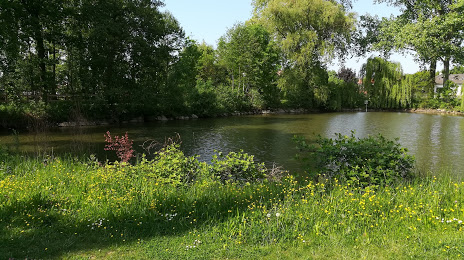
Photo
Where is located Urbain du Niederholz Natural Park
Urbain du Niederholz Natural Park — local attraction, which is located at Rue Niederholz, 67201 Eckbolsheim, France and belongs to the category — park. Average visitor rating for this place — 4.1 (according to 140 ratings, information from open sources and relevant for 2022).
Exact location — Urbain du Niederholz Natural Park, marked on the map with a red marker.
You can get directions to Urbain du Niederholz Natural Park on the map from your location.
What else is interesting in Lingolsheim? You can see all the sights if you go to the city page.
Coordinates
Urbain du Niederholz Natural Park, France coordinates in decimal format: latitude — 48.57365680147424, longitude — 7.6927084981892415. When converted to degrees, minutes, seconds Urbain du Niederholz Natural Park has the following coordinates: 48°34′25.16 north latitude and 7°41′33.75 east longitude.
Nearby cities
The largest cities that are located nearby:
- Strasbourg — 6 km
- Freiburg
 (Germany) — 63 km
 - Karlsruhe (Germany) — 72 km
- Pforzheim (Germany) — 83 km
- Saarbrücken (Germany) — 91 km
- Mulhouse — 92 km
- Basel
 (Switzerland) — 109 km
 - Nancy — 110 km
- Reutlingen (Germany) — 112 km
- Stuttgart (Germany) — 112 km
- Ludwigshafen (Germany) — 116 km
- Heidelberg (Germany) — 117 km
- Mannheim (Germany) — 118 km
- Metz — 126 km
- Heilbronn (Germany) — 128 km
- Zurich (Switzerland) — 146 km
- Trier (Germany) — 152 km
- Darmstadt (Germany) — 161 km
- Mainz (Germany) — 164 km
Distance to the capital
Distance to the capital (Paris) is about — 393 km.