
 Maureville
Samoëns
Gréning
Toulouse
Volx
Goudet
Méhoncourt
Saint-Hymer
Pontcarré
Maureville
Samoëns
Gréning
Toulouse
Volx
Goudet
Méhoncourt
Saint-Hymer
Pontcarré
La Gare d'Eau on the map, Béthune, France
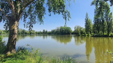
Photo
Where is located La Gare d'Eau
La Gare d'Eau — local attraction, which is located at Unnamed Road, 62400, Béthune, France and belongs to the category — park. Average visitor rating for this place — 4.2 (according to 866 ratings, information from open sources and relevant for 2022).
Exact location — La Gare d'Eau, marked on the map with a red marker.
You can get directions to La Gare d'Eau on the map from your location.
What else is interesting in Béthune? You can see all the sights if you go to the city page.
Coordinates
La Gare d'Eau, France coordinates in decimal format: latitude — 50.53511043341379, longitude — 2.652854598259377. When converted to degrees, minutes, seconds La Gare d'Eau has the following coordinates: 50°32′6.4 north latitude and 2°39′10.28 east longitude.
Nearby cities
The largest cities that are located nearby:
- Lille — 31 km
- Amiens — 75 km
- Brussels
 (Belgium) — 125 km
 - Charleroi (Belgium) — 128 km
- Antwerp (Belgium) — 144 km
- Namur (Belgium) — 157 km
- Rouen — 163 km
- Eastbourne
 (United Kingdom) — 166 km
 - Gillingham (United Kingdom) — 172 km
- Reims — 173 km
- Southend-on-Sea (United Kingdom) — 174 km
- Breda
 (Netherlands) — 187 km
 - Basildon (United Kingdom) — 188 km
- Boulogne-Billancourt — 189 km
- Ipswich (United Kingdom) — 197 km
- Rotterdam (Netherlands) — 199 km
- Dordrecht (Netherlands) — 199 km
- Chelmsford (United Kingdom) — 200 km
- Tilburg (Netherlands) — 203 km
Distance to the capital
Distance to the capital (Paris) is about — 188 km.