
 Maureville
Samoëns
Gréning
Toulouse
Volx
Goudet
Méhoncourt
Saint-Hymer
Pontcarré
Maureville
Samoëns
Gréning
Toulouse
Volx
Goudet
Méhoncourt
Saint-Hymer
Pontcarré
Lac de la Dathée on the map, Vire, France
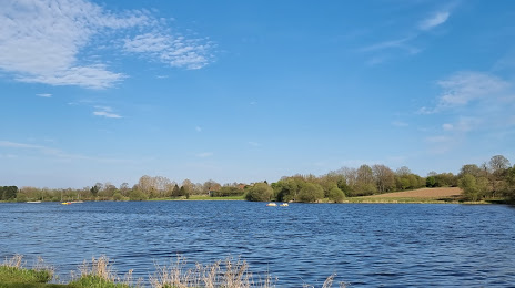
Photo
Where is located Lac de la Dathée
Lac de la Dathée — local attraction, which is located at no data and belongs to the category — -. Average visitor rating for this place — 4.5 (according to 146 ratings, information from open sources and relevant for 2022).
Exact location — Lac de la Dathée, marked on the map with a red marker.
You can get directions to Lac de la Dathée on the map from your location.
What else is interesting in Vire? You can see all the sights if you go to the city page.
Coordinates
Lac de la Dathée, France coordinates in decimal format: latitude — 48.8104395299332, longitude — -0.9541666784461056. When converted to degrees, minutes, seconds Lac de la Dathée has the following coordinates: 48°48′37.58 north latitude and -0°57′15 east longitude.
Nearby cities
The largest cities that are located nearby:
- Caen — 53 km
- Rennes — 99 km
- Le Havre — 102 km
- Le Mans — 122 km
- Angers — 152 km
- Rouen — 158 km
- Nantes — 186 km
- Tours — 198 km
- Bournemouth
 (United Kingdom) — 219 km
 - Portsmouth (United Kingdom) — 220 km
- Boulogne-Billancourt — 228 km
- Eastbourne (United Kingdom) — 229 km
- Orléans — 232 km
- Southampton (United Kingdom) — 232 km
- Amiens — 255 km
- Crawley (United Kingdom) — 256 km
- Brest — 269 km
- Exeter (United Kingdom) — 278 km
- Sutton (United Kingdom) — 283 km
Distance to the capital
Distance to the capital (Paris) is about — 242 km.