
 Maureville
Samoëns
Gréning
Toulouse
Volx
Goudet
Méhoncourt
Saint-Hymer
Pontcarré
Maureville
Samoëns
Gréning
Toulouse
Volx
Goudet
Méhoncourt
Saint-Hymer
Pontcarré
Domaine de Montéclin on the map, Vélizy-Villacoublay, France
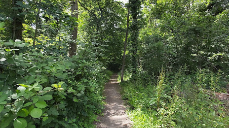
Photo
Where is located Domaine de Montéclin
Domaine de Montéclin — local attraction, which is located at Rd 53, 91570 Bièvres, France and belongs to the category — park. Average visitor rating for this place — 4.2 (according to 45 ratings, information from open sources and relevant for 2022).
Exact location — Domaine de Montéclin, marked on the map with a red marker.
You can get directions to Domaine de Montéclin on the map from your location.
What else is interesting in Vélizy-Villacoublay? You can see all the sights if you go to the city page.
Coordinates
Domaine de Montéclin, France coordinates in decimal format: latitude — 48.7675005609523, longitude — 2.191699698196101. When converted to degrees, minutes, seconds Domaine de Montéclin has the following coordinates: 48°46′3 north latitude and 2°11′30.12 east longitude.
Nearby cities
The largest cities that are located nearby:
- Boulogne-Billancourt — 7 km
- Orléans — 100 km
- Rouen — 107 km
- Amiens — 123 km
- Reims — 143 km
- Le Havre — 169 km
- Le Mans — 171 km
- Caen — 190 km
- Tours — 191 km
- Lille — 212 km
- Charleroi
 (Belgium) — 240 km
 - Angers — 252 km
- Eastbourne
 (United Kingdom) — 256 km
 - Namur (Belgium) — 265 km
- Dijon — 268 km
- Brussels (Belgium) — 273 km
- Metz — 291 km
- Nancy — 292 km
- Rennes — 295 km
Distance to the capital
Distance to the capital (Paris) is about — 15 km.