
 Ellhofen
Schönwald im Schwarzwald
Landwehr
Paunzhausen
Ottersweier
Birkenbeul
Edenkoben
Bindlach
Braschwitz
Stephanskirchen
Brehna
Leopoldshöhe
Wittingen
Ostheim
Dörfles-Esbach
Malsch
Oppenweiler
Landsberg am Lech
Tirschenreuth
Ellhofen
Schönwald im Schwarzwald
Landwehr
Paunzhausen
Ottersweier
Birkenbeul
Edenkoben
Bindlach
Braschwitz
Stephanskirchen
Brehna
Leopoldshöhe
Wittingen
Ostheim
Dörfles-Esbach
Malsch
Oppenweiler
Landsberg am Lech
Tirschenreuth
Plauen on the map, Germany
Where is located Plauen
Exact location — Plauen, Chemnitz, Saxony, Germany, marked on the map with a red marker.
Coordinates
Plauen, Germany coordinates in decimal format: latitude — 50.4976133, longitude — 12.1368679. When converted to degrees, minutes, seconds Plauen has the following coordinates: 50°29′51.41 north latitude and 12°8′12.72 east longitude.
Population
Plauen, Chemnitz, Saxony, Germany, according to our data the population is — 69,378 residents, which is about 0.1% of the total population of the country (Germany).
Comparison of the population on the graph:
Exact time
Time zone for this location Plauen — UTC +2 Europe/Berlin. Exact time — monday, 4 april 2024 year, 17 h. 43 minutes.
Sunrise and sunset
Plauen, sunrise and sunset data for a date — monday 29.04.2024.
| Sunrise | Sunset | Day (duration) |
|---|---|---|
| 05:52 -2 minutes | 20:24 +1 minute | 14 h. 30 minutes. +3 minutes |
You can control the scale of the map using the auxiliary tools to find out exactly where it is located Plauen. When you change the scale of the map, the width of the ruler also changes (in kilometers and miles).
Nearby cities
The largest cities that are located nearby:
- Gera — 43 km
- Chemnitz — 66 km
- Erfurt — 94 km
- Leipzig — 95 km
- Pilsen
 (Czech Republic) — 122 km
 - Dresden — 127 km
- Erlangen — 129 km
- Nuremberg — 138 km
- Fürth — 140 km
- Regensburg — 164 km
- Prague (Czech Republic) — 170 km
- Würzburg — 174 km
- Magdeburg — 183 km
- Göttingen — 191 km
- Ingolstadt — 198 km
- Kassel — 205 km
- Cottbus — 205 km
- Potsdam — 218 km
- Salzgitter — 220 km
Distance to neighboring capitals:
- Prague (Czech Republic) — 170 km
- Vienna
 (Austria) — 399 km
 - Vaduz
 (Liechtenstein) — 420 km
 - Ljubljana
 (Slovenia) — 524 km
 - Bern
 (Switzerland) — 524 km
 - Amsterdam
 (Netherlands) — 543 km
 - Brussels
 (Belgium) — 550 km
 - Copenhagen
 (Denmark) — 577 km
 - Warsaw
 (Poland) — 645 km
 - Paris
 (France) — 727 km
 - Paris (France) — 727 km
- Rome
 (Italy) — 956 km
 - Stockholm
 (Sweden) — 1047 km
 - Oslo
 (Norway) — 1051 km
 - Minsk
 (Belarus) — 1115 km
 - Kyiv
 (Ukraine) — 1298 km
 - Helsinki
 (Finland) — 1342 km
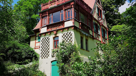
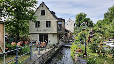
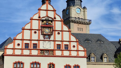
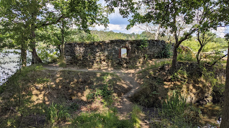
Attractions


Distance to the capital
Distance to the capital (Berlin) is about — 241 km.